|
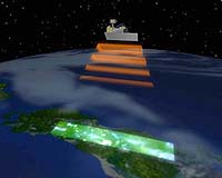
Paris (ESA) Jan 25, 2006 ALOS, Japan's latest Earth Observation satellite, was successfully launched at 02:33 CET (10:33 Japan time) on 24 January. Environmental data and imagery from ALOS will be provided to European and African users through a cooperative agreement between ESA and the Japan Aerospace Exploration Agency (JAXA). The Advanced Land Observing Satellite (ALOS) is a four-tonne satellite dedicated to land-based Earth Observation. It was lifted-off from the Tanegashima Space Centre on an H-IIA launch vehicle, which will deliver ALOS into a 700-km polar orbit. ESA is supporting ALOS as a 'Third Party Mission', which means the Agency will utilise its multi-mission ground systems of existing national and industrial facilities and expertise to acquire, process and distribute data from the satellite. Based on a Memorandum of Understanding with JAXA, approved at ESA Council in December and now ready for signature, ESA will host the ALOS European Data Node (ADEN), delivering near-real time and offline data to scientific and operational users across Europe as well as Africa. ALOS has multiple objectives: to support improved cartography, especially within the Asia-Pacific region, to gather environmental observations in support of sustainable development efforts, to survey natural resources, to develop technologies for further Earth Observation missions and to monitor disasters on a worldwide basis � JAXA having signed the International Charter on Major Disasters in February 2005. The satellite carries a payload of three instruments: the Phased Array type L-band Synthetic Aperture Radar (PALSAR), a microwave radar instrument that can acquire observations during both day and night and through any weather conditions; the Panchromatic Remote-sensing Instrument of Stereo Mapping (PRISM) which can observe selected areas in three dimensions, down to a high 2.5-metre spatial resolution; and the Advanced Visible and Near Infrared Radiometer type-2 (AVNIR-2), designed to chart land cover and vegetation in visible and near infrared spectral bands. Observing in L-band wavelength, PALSAR will complement ESA radar instruments currently flying on ERS-2 and Envisat operating in C-band wave, and the European national missions TerraSAR-X and Cosmo SkyMed, operating in the even shorter X-band. Regarding optical sensors, the very high resolution together with the stereo mapping and DEM generation capability of PRISM will be particularly valuable. AVNIR-2 will provide in addition high resolution multispectral imagery for use in local to regional studies, complementing the optical data from medium resolution instruments currently available from ESA. Following launch, a nine month commissioning phase will begin, with products set to be available to users from November 2006. ALOS data will be made available at conditions similar to those of ERS and Envisat missions, namely for scientific 'Category-1' use as well as commercial applications. An ESA Announcement of Opportunity for scientific use of ALOS data has already received almost 150 proposals which are currently undergoing evaluation by scientific experts from ESA Member States and JAXA. Operational and commercial users will be able to receive ALOS data via commercial distribution schemes. ALOS data will also be available for Global Monitoring for Environment and Security (GMES), the joint initiative by ESA and the European Union to develop an independent environmental monitoring capability for Europe. Community Email This Article Comment On This Article Related Links http://www.esa.int/esaCP/SEM0SXMZCIE_index_0.html-->ALOS launch website ALOS mission website Earth Observation News - Suppiliers, Technology and Application
 Paris, France (ESA) Jan 23, 2006
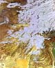
Winter snow blankets the heights of the Pamir Mountains and the Hindu Kush in this Envisat image acquired over Central Asia, the snow cover extending to surrounding desert lowlands. |
|
| The content herein, unless otherwise known to be public domain, are Copyright 1995-2006 - SpaceDaily.AFP and UPI Wire Stories are copyright Agence France-Presse and United Press International. ESA PortalReports are copyright European Space Agency. All NASA sourced material is public domain. Additionalcopyrights may apply in whole or part to other bona fide parties. Advertising does not imply endorsement,agreement or approval of any opinions, statements or information provided by SpaceDaily on any Web page published or hosted by SpaceDaily. Privacy Statement |