|
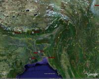
Mountain View CA (SPX) Jun 14, 2006 Google has announced a series of updates to the company's mapping product suite, further illustrating Google's commitment to creating powerful tools for sharing geographic information. Announced live at Google's first Geo Developer Day, these innovations both connect users to information about the world around them, as well as address the growing needs of the developer community. "We are excited to celebrate the one year anniversary of Google Earth and the Google Maps API with new technologies for these products," said John Hanke, director, Google Earth and Maps. "In the past year, we have had more than 100 million unique Google Earth downloads and have enabled over 30,000 websites to create mash-ups combining their own geographic data with the Google Maps API. The enthusiasm of the geo-developer community encourages us that these geo-based tools are connecting users to information in new and innovative ways." Google Earth news announced today includes: Satellite imagery update: A significant high-resolution imagery update for Google Earth increases the product's index of high-resolution imagery by four times. This makes sub-meter high-resolution imagery available for more than one third of the world's population. While initially available only in Google Earth, this database will also be accessible in Google Maps shortly. New version of Google Earth: In the product's first major update since its launch one year ago, Google Earth now features a more streamlined user interface and new tools that enable the creation and display of third party and user generated content. The addition of textured buildings brings a new level of realism and detail to Google Earth's 3D world. Google Earth is also now available for the Windows, Mac and, for the first time, Linux operating platforms; and is fully localized in French, Italian, German and Spanish. Google SketchUp with textured buildings: In coordination with the release of Google Earth, Google SketchUp now enables the creation of textured buildings for visualization in Google Earth and the Google 3D Warehouse. Google also announced several updates to Google Maps and the Google Maps API (Application Programming Interface), the developer tool that enables users to easily embed Google's interactive, dynamic maps into their own websites. These innovations include: Google Maps API: In response to developer feedback, an update to the Google Maps API enables developers of Google Maps-powered mash-ups, or websites that merge geographic information with Google Maps, to integrate data based on addresses. This ability to geocode addresses using the Google Maps API is the most requested feature from Maps API users. KML for Google Maps: A new feature of Google Maps enables the display of KML (Keyhole Markup Language, the file format used by Google Earth and other applications to share geographic information) on Google Maps. This innovation enables data created in Google Earth to be viewed in a web browser as a simple mash-up. Requiring no computer programming expertise, KML for Google Maps makes the sharing of geographic information even easier. Google Maps for Enterprise: Addressing the needs of the enterprise community, Google announced fee-based licensing and support for businesses wanting to embed a Google Maps experience in websites or internal applications. Leveraging the Google Maps API, this product enables businesses to map customer locations, track shipments, manage facilities or view any other data source in a geographic context. Community Email This Article Comment On This Article Related Links Google Earth The Google Maps API Earth Observation News - Suppiliers, Technology and Application
 Seattle WA (SPX) Jun 13, 2006
NASA's Cloud-Aerosol Lidar and Infrared Pathfinder Satellite Observation spacecraft has begun gathering data from the Earth's atmosphere that are expected to become a key tool in unraveling just how much effect the reflectivity of clouds and tiny particles called aerosols are having on the planet's changing climate. |
|
| The content herein, unless otherwise known to be public domain, are Copyright 1995-2006 - SpaceDaily.AFP and UPI Wire Stories are copyright Agence France-Presse and United Press International. ESA PortalReports are copyright European Space Agency. All NASA sourced material is public domain. Additionalcopyrights may apply in whole or part to other bona fide parties. Advertising does not imply endorsement,agreement or approval of any opinions, statements or information provided by SpaceDaily on any Web page published or hosted by SpaceDaily. Privacy Statement |