|
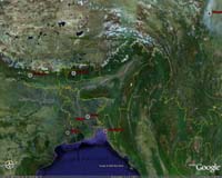
Paris, France (ESA) Nov 17, 2006 Ever wanted to see what volcanic eruptions, dust storms and changing ice glaciers look like from space? The European Space Agency (ESA) has created a special layer of content that will appear in Google Earth, enabling people to see over 130 new ESA satellite images including natural phenomena and manmade landmarks such as the Palm Islands in Dubai. The new images can be accessed easily by clicking on the 'Featured Content' checkbox in the Google Earth sidebar and further clicking on the ESA icon. People can take a journey around the globe, exploring detailed images of amazing landmarks and finding out about important changes to the environment. Helpful information, bubbles of facts and figures, scientific explanations and theories will appear underneath the images. Google Earth Director John Hanke said: "We are inspired to see the European Space Agency using Google Earth to show such fascinating information about our planet through these striking images. This is another important step in helping people around the world to understand more about their environment." ESA's Director of Earth Observation Programmes Dr. Volker Liebig said: "Integrating ESA images into Google Earth provides an excellent opportunity to create public awareness and interest for space technologies, and in particular for those related to Earth observation and the protection of the environment. "The imagery has been specifically chosen to afford Google Earth users the possibility to tour the planet from a bird's eye view and to gain a different perspective and appreciation of their planet by witnessing its splendour as well as its vulnerable spots." The images in the collection are acquired by ESA's Envisat - the largest environmental satellite ever built - ERS and Proba satellites. ESA's Envisat, launched in 2002, acquires data using three imaging sensors: Advanced Synthetic Aperture Radar (ASAR), Medium Resolution Imaging Spectrometer (MERIS) and Advanced Along-Track Scanning Radiometer (AATSR). The ASAR instrument uses radar to map the land, profile waves and ice, monitor land use and types of vegetation and measure some of the properties of the surface. MERIS acquires images of the planet's surface and clouds in sunlight, capturing visible light and some of the infrared part of the spectrum. The AATSR sensor scans land and ocean surfaces to measure sea temperature, detect hot spots from forest fires and map the extent of vegetation in different regions. Data from these sensors play a vital role in helping scientists, governments and others to understand the causes and consequences of global environmental changes - including detecting El Nino events, unravelling the mysteries of global warming, tracking global deforestation and pollution and gaining crucial insights into the rise in ocean levels. 'Featured Content' on Google Earth was launched in September and provides an opportunity for content providers like ESA to showcase content such as famous landmarks and scientific information. Other providers on 'Featured Content' include: United Nations Environmental Programme - The UNEP overlay for Google Earth includes successive time-stamped images illustrating 100 areas of extreme environmental degradation around the world. From the deforestation of the Amazon to the fallout of raging forest fires in Sub-Sahara Africa and the decline of the Aral Sea in Central Asia, this before-and-after imagery spanning the past 30 years offers users an online resource for learning about environmental crisis zones around the world. Discovery Networks World Tour - The Discovery overlay enables travel enthusiasts and armchair tourists alike the opportunity to virtually visit major world attractions, cities, and natural wonders through Google Earth. Featuring streaming Discovery video segments, users can learn about the history and significance of various world landmarks, national parks, American and European cities, and African locations. These multimedia vignettes introduce users to the wonders of King Tut's tomb in the Valley of Kings to the history of the gate of the Itsukushima Shrine in Japan. Jane Goodall Institute - With the Jane Goodall Institute overlay users can visit Fifi and the other Gombe preserve chimpanzees and follow their daily exploits with the Institute's 'geo-blog' in Google Earth. Updated daily, this geo-blog captures the work of the Jane Goodall Institute, illustrating the Institute's research on chimpanzees and the effects of deforestation in Africa. Community Email This Article Comment On This Article Related Links Envisat overview ERS overview Proba overview Google Earth Making money out of watching earth from space today Earth Observation News - Suppiliers, Technology and Application
 Orlando FL (SPX) Nov 16, 2006
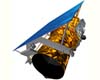
In anticipation of the spring 2007 launch of an extremely high-resolution Earth imagery satellite, GeoEye, the world's largest commercial satellite remote-sensing company, purchased high-bandwidth, high-performance compute technology from SGI. |
|
| The content herein, unless otherwise known to be public domain, are Copyright 1995-2006 - SpaceDaily.AFP and UPI Wire Stories are copyright Agence France-Presse and United Press International. ESA PortalReports are copyright European Space Agency. All NASA sourced material is public domain. Additionalcopyrights may apply in whole or part to other bona fide parties. Advertising does not imply endorsement,agreement or approval of any opinions, statements or information provided by SpaceDaily on any Web page published or hosted by SpaceDaily. Privacy Statement |