|
Orlando FL (SPX) Nov 16, 2006 In anticipation of the spring 2007 launch of an extremely high-resolution Earth imagery satellite, GeoEye, the world's largest commercial satellite remote-sensing company, purchased high-bandwidth, high-performance compute technology from SGI. At the Dulles, VA, ground station for the new GeoEye-1 satellite, four SGI(R) Altix(R) systems were delivered during the first calendar quarter that will drive core satellite image processing for the .41-meter panchromatic (sensitive to all visible colors) and 1.65-meter multi-spectral (sensing and recording radiation from invisible as well as visible parts of the electromagnetic spectrum) imagery. GeoEye-1 is anticipated to collect more than 700,000 square kilometers -- billions of bytes -- of high-resolution imagery every day. A long-time SGI customer supplying imagery to the U.S. government, international governments and a growing number of commercial clients, GeoEye selected SGI systems because the record amounts of image data from the new satellite will require 4X the processing power. "We have three satellites currently in orbit -- OrbView-2 and 3, and IKONOS -- but when GeoEye-1 becomes fully operational, it will be the world's most powerful and most accurate high-resolution commercial imaging satellite. It's going to collect more imagery on a given day than any commercial system currently on orbit," said Don Koboldt, senior principal geodetic engineer, GeoEye. "I chose SGI Altix because it has 64-bit processing power, not 32, and because there's a lot of computing power required for everything we do, including modeling the sensor and re-sampling all this data onto a geographic system. Not to mention the actual volumes of pixel data that has to be processed. It's both an I/O-bound problem and a compute problem, and SGI is taking the lead in designing systems for this need." The GeoEye-1 satellite's ability to go down to a .41-meter resolution means, in simple terms, the high-resolution imagery taken from orbit and processed by the SGI(R) Altix(R) 350 systems will be capable of discerning objects on the ground 16 inches in size or larger. At that resolution, one would be able to identify home plate on a baseball diamond or count the manholes on a city street. In general, GeoEye's products are utilized in a wide variety of applications including defense and intelligence for large area mapping, state and local governments for urban planning and mapping, insurance and risk management, environmental monitoring and disaster relief. Such imagery is also ideal for on-line mapping search engines. GeoEye recently won a $19.6 million contract with the U.S. Government to supply imagery and value-added products and services to several Federal agencies including the United States Department of Agriculture (USDA), National Park Service, and the National Geospatial-Intelligence Agency (NGA). GeoEye uses a variety of off-the-shelf software and writes many in-house propriety codes at its St. Louis office, where much of the high end value- added work for the U.S. Government is produced. All the codes are written to be multi-platform, which makes the open system, Linux(R) environment of the SGI Altix systems perfectly compatible with the requirements set by the company. With the scheduled launch of GeoEye-1 from the Vandenberg Air Force Base in California, the company expects even greater sales from government, commercial and local government interests. GeoEye is especially seeking to expand their offerings into other markets that need high-resolution map- accurate imagery. "today imagery is in 'soft' copy, that is, digital format, and you can accurately position locations on any of the image sets," said Koboldt, a former 10-year veteran of NGA who helped design components of the GeoEye-1 ground system. "In other words we'll know exactly where everything is-to within a few meters of that object's true location on the surface of the globe. If you want to know where something is in terms of position, you could do it by using our image products and measuring on the screen. In addition to accuracy improvement, images are getting bigger, the amount of data is getting larger, and the Altix will let us step up a little more in terms of image sizes and file system sizes as well." GeoEye purchased four SGI Altix 350 systems with 16 Intel(R) Itanium(R) 2 processors on each system. The SGI Altix systems run Novell(R) SUSE(R) Linux Enterprise Server, version 9, ensuring the Altix deployment dovetails with existing GeoEye applications. The four SGI Altix systems will be attached to a storage area network that will also include a previously purchased SGI(R) Altix(R) 3700 server, which will be used for image reconstruction activities when GeoEye-1 is launched. "The power of 64-bit SGI Altix systems is ideal for the massive data processing needs of high-resolution Earth imagery satellite data," said Gene Gray, government and defense market segment manager, SGI. "Commercial satellite data companies such as the world-leading GeoEye, government labs, as well as NASA, NOAA, private weather forecasting companies, and leading universities involved in weather research and catastrophe relief, all rely on the processing power of SGI technology to deliver the data sets necessary to protect and serve America and the world." Community Email This Article Comment On This Article Related Links GeoEye SGI All about the technology of space and more Earth Observation News - Suppiliers, Technology and Application
 Chippenham, UK (SPX) Nov 14, 2006
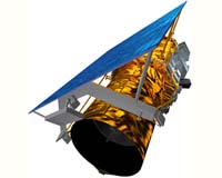
SciSys, a leading provider of software services, has announced a major contract from EADS Astrium Gmbh to develop on-board satellite software for CryoSat-2, a key mission in the European Space Agency's Living Planet programme. CryoSat-2 is a 3.5 year radar mission, scheduled for launch in 2009 and replaces its CryoSat predecessor that was unfortunately aborted in 2005 due to a failure of the Russian supplied Rockot launcher. |
|
| The content herein, unless otherwise known to be public domain, are Copyright 1995-2006 - SpaceDaily.AFP and UPI Wire Stories are copyright Agence France-Presse and United Press International. ESA PortalReports are copyright European Space Agency. All NASA sourced material is public domain. Additionalcopyrights may apply in whole or part to other bona fide parties. Advertising does not imply endorsement,agreement or approval of any opinions, statements or information provided by SpaceDaily on any Web page published or hosted by SpaceDaily. Privacy Statement |