|
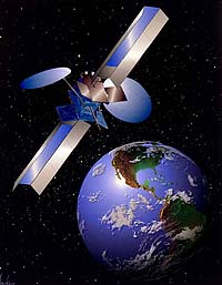
New York NY - Apr 08, 2004 XM Satellite Radio has released a new satellite data information service called XM NavTraffic. The service is powered by NAVTEQ Traffic, a new product from NAVTEQ, the leading global provider of digital map data for vehicle navigation systems. XM NavTraffic is the nation's first satellite traffic information service that enables a vehicle's on-board navigation system to display current traffic information for a driver's chosen route. XM NavTraffic will debut this fall as the provider of traffic data to the AcuraLink communication system that will be a standard feature on the all-new 2005 Acura RL. The Acura Satellite Navigation System will provide drivers with real-time traffic information integrated with an in- vehicle navigation system, a first in North America. "The XM NavTraffic information service provides the critical infrastructure side of Acura's advanced navigation capabilities," said Tom Elliott, executive vice president of American Honda Motor Co., Inc. XM NavTraffic is designed to fully integrate with the vehicle's on-board navigation system to display current information about traffic incidents, average traffic speed along specific roadways, and estimated travel times based on traffic conditions. This information is delivered to the vehicle by the XM Radio satellites, which cover the U.S. from coast to coast. XM NavTraffic makes it possible for on-board vehicle navigation systems to provide continuously updated traffic information personalized for each driver's needs. Later this year, General Motors is expected to offer XM NavTraffic as an optional integrated feature on select 2005 Cadillac CTS vehicles. XM and NAVTEQ will demonstrate the XM NavTraffic service this week at the New York International Auto Show in Booth CP11 at the Crystal Palace in the Jacob Javits Center. "XM NavTraffic, when integrated into vehicles, is a powerful tool for U.S. drivers to understand, anticipate, and avoid traffic congestion," said Hugh Panero, President and CEO of XM Satellite Radio. "The XM NavTraffic technology will help bring personalized, route-specific traffic information further into the mainstream," Panero said.
XM NavTraffic offers:
+ Unscheduled traffic incident data, such as accidents and disabled vehicles
Using NAVTEQ information is combined from a variety of sources
+ Road sensors, which measure vehicle speed To deliver seamless traffic data for the XM NavTraffic service, NAVTEQ Traffic aggregates the data from multiple sources across the country, including the leading commercial traffic data providers, government departments of transportation, police & emergency services, road sensors, cameras and real-time aircraft reports. NAVTEQ Traffic performs extensive data quality processing to provide the most complete and accurate information feed of nationwide traffic. The traffic data is continuously broadcast via XM's network of satellites and ground-based repeaters, ensuring that the latest information is always available to the driver. XM NavTraffic will be offered as a premium service with XM's 2004 line-up of 120-plus channels of commercial-free music and premiere news, sports, talk, and entertainment. Final pricing will be announced prior to launch. XM will broadcast nationally the traffic information for 20 markets this fall: Atlanta, Baltimore, Boston, Chicago, Dallas/Ft. Worth, Detroit, Houston, Los Angeles, Miami-Ft. Lauderdale, Minneapolis-St. Paul, New York City, Philadelphia, Phoenix, Pittsburgh, San Diego, San Francisco/Oakland, San Jose, Seattle, St. Louis, and Washington, D.C. XM and NAVTEQ plan to expand the service to cover additional markets in the future. Community Email This Article Comment On This Article Related Links XM Radio SpaceDaily Search SpaceDaily Subscribe To SpaceDaily Express GPS Applications, Technology and Suppliers
 Cheltenham, England (SPX) Jan 09, 2006
Marotta UK is pleased to announce that it designed, developed and qualified equipment for the cold gas propulsion systems on board the Galileo GIOVE-A, part of Europe's Galileo navigation program, successfully launched by Surrey Satellite Technology (SSTL). |
|
| The content herein, unless otherwise known to be public domain, are Copyright 1995-2006 - SpaceDaily.AFP and UPI Wire Stories are copyright Agence France-Presse and United Press International. ESA PortalReports are copyright European Space Agency. All NASA sourced material is public domain. Additionalcopyrights may apply in whole or part to other bona fide parties. Advertising does not imply endorsement,agreement or approval of any opinions, statements or information provided by SpaceDaily on any Web page published or hosted by SpaceDaily. Privacy Statement |