 |
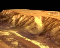
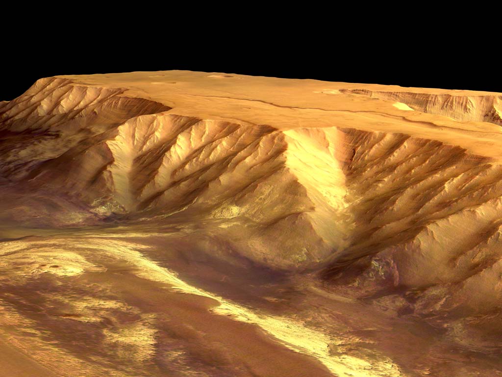
Paris (ESA) Dec 23, 2004 These images, taken by the High Resolution Stereo Camera (HRSC) on board ESA's Mars Express spacecraft, show Candor Chasma - one of the largest canyons in the Valles Marineris canyon system. The HRSC obtained image data in orbit 360 with a ground resolution of approximately 40 metres per pixel. The image was shows a region centred around 5� South latitude and 285� East longitude. Traces of erosion can be observed at the canyon walls, which are similar to erosional features observed on Earth in arid or alpine regions. The high-standing plateaus, which have an elevation of approximately six kilometres, have a very flat surface and most likely consist of several layers of basaltic lava. While it is unclear how the canyon system formed, it seems probable that tension and fracturing of the upper crust produced a widening of the canyon and subsequent lowering of the valley floor (a so-called tectonic 'graben'). It is also thought that Valles Marineris could be a possible 'rift', which occurs when tensional fractures go deeper than the relatively elastic lithosphere (or crust). An alternative theory about the formation of the canyon system is the removal of rock from the subsurface material, as a result of water activity, and subsequent collapse of the surface. This process is analogous to the formation of terrestrial 'karst' landscapes. It could also be possible that large amounts of ice under the surface melted and this meltwater formed the large outflow channels in the north. As a result, the surface collapsed where substantial amounts of ice were removed, forming the Valles Marineris system as we see it today. The colour images were processed using the HRSC nadir (vertical view) and three colour channels. The perspective views were calculated from the digital terrain model derived from the stereo channels. The 3D anaglyph image was created from the nadir channel and one of the stereo channels. Stereoscopic glasses are needed to view the 3D image. Image resolution has been decreased for use on the internet. Community Email This Article Comment On This Article Related Links Mars Express SpaceDaily Search SpaceDaily Subscribe To SpaceDaily Express Mars News and Information at MarsDaily.com Lunar Dreams and more
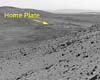 Pasadena CA (JPL) Jan 09, 2006
Last week Spirit completed robotic-arm work on "El Dorado." The rover used all three of its spectrometers plus the microscopic imager for readings over the New Year's weekend. |
|
| The content herein, unless otherwise known to be public domain, are Copyright 1995-2006 - SpaceDaily.AFP and UPI Wire Stories are copyright Agence France-Presse and United Press International. ESA PortalReports are copyright European Space Agency. All NASA sourced material is public domain. Additionalcopyrights may apply in whole or part to other bona fide parties. Advertising does not imply endorsement,agreement or approval of any opinions, statements or information provided by SpaceDaily on any Web page published or hosted by SpaceDaily. Privacy Statement |
