|
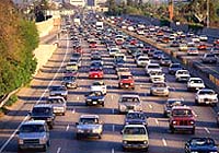
Washington (SPX) Jun 16, 2004 If all the highways, streets, buildings, parking lots and other solid structures in the 48 contiguous United States were pieced together like a giant jigsaw puzzle, they would almost cover the state of Ohio. That is the result of a study by Christopher Elvidge of the National Oceanic and Atmospheric Administration's National Geophysical Data Center in Boulder, Colorado, who along with colleagues from several universities and agencies produced the first national map and inventory of impervious surface areas (ISA) in the United States. As calculated by the researchers, the total impervious surface area of the 48 states and District of Columbia is approximately 112,610 square kilometers [43,480 square miles], and, for comparison, the total area of the state of Ohio is 116,534 square kilometers [44,994 square miles]. The new map is important, because impervious surface areas affect the environment. The qualities of impervious materials that make them ideal for construction also create urban heat islands, by reducing heat transfer from Earth's surface to the atmosphere. The replacement of heavily vegetated areas by ISA reduces sequestration of carbon, which plants absorb from the atmosphere, Elvidge says in the 15 June issue of Eos, published by the American Geophysical Union. Both of these effects can play a role in climate change. In watersheds, impervious surface areas alter the shape of stream channels, raise the water temperature, and sweep urban debris and pollutants into aquatic environments. These effects are measurable once ten percent of a watershed's surface area is covered by ISA, Elvidge writes. The consequences of increased ISA include fewer fish and fewer species of fish and aquatic insects, as well as a general degradation of wetlands and river valleys. The impervious surface area of the contiguous United States is already slightly larger than that of its wetlands, which is 98,460 square kilometers [38,020 square miles]. Elvidge notes that few areas have ISA maps, because they are difficult and expensive to create. He used a variety of data sources to produce the map accompanying his article, including nighttime lights observed by satellite, Landsat images, and data on roads from the U.S. Census Bureau, along with aerial photography. He anticipates that this map will be useful to scientists and planners managing conservation and resource allocation, as well as those working on issues of water quality, biodiversity, habitat loss and fragmentation, and climate change. The population of the United States is increasing by three million persons annually, Elvidge writes. New impervious surface areas are rapidly covering vegetated surfaces, including one million new single family homes and 20,000 kilometers [10,000 miles] of new roads per year. Given these trends, he says, ISA will likely become a more prominent issue in coming years. Community Email This Article Comment On This Article Related Links National Oceanic & Atmospheric Administration National Geophysical Data Center SpaceDaily Search SpaceDaily Subscribe To SpaceDaily Express Earth Observation News - Suppiliers, Technology and Application
 New York NY (SPX) Jan 11, 2006
The importance of remotely sensed data and technologies to support natural disasters has prompted attention and action in Washington. New initiatives and legislation authorizing appropriations to the remote sensing industry will be discussed at Strategic Research Institute's U.S. Commercial Remote Sensing Industry conference, scheduled for February 9-10, 2006 in Washington D.C. |
|
| The content herein, unless otherwise known to be public domain, are Copyright 1995-2006 - SpaceDaily.AFP and UPI Wire Stories are copyright Agence France-Presse and United Press International. ESA PortalReports are copyright European Space Agency. All NASA sourced material is public domain. Additionalcopyrights may apply in whole or part to other bona fide parties. Advertising does not imply endorsement,agreement or approval of any opinions, statements or information provided by SpaceDaily on any Web page published or hosted by SpaceDaily. Privacy Statement |