|
Brussels - Dec 30, 2003 EUREKA project E! 2294 IMAGIN -- the "Integrated Machine Guidance Instruments" -- uses satellite navigation to automatically guide and control road and rail construction machines with incredible accuracy. The IMAGIN device is a special dual-frequency Global Positioning Satellite (GPS) receiver that is attached to an engineering machine and uses the GPS system to plot and check its exact position at any moment in time. Once a project is described by a civil engineer and the instructions transferred to the IMAGIN on-board computer, the motor grader, bulldozer or excavator is then automatically controlled by comparing its actual and desired positions, making corrections as required. "The principle of IMAGIN can be applied to any civil engineering machine, whatever its task," explains Christophe Pichot, Strategy and Business Development Manager of French lead partner, THALES-Navigation. It has been used successfully on bulldozers, hydraulic excavators and marine survey ships, but most demanding in terms of accuracy and speed is the control of motor graders that are used in the final finishing of road or railway construction where high levels of accuracy are required over tens of kilometres. "Although automatic control has been possible using laser guidance, the IMAGIN GPS system makes it possible to work accurately in automatic mode, guaranteeing the quality of the work, preventing excessive cutting of the material and reducing waste," says Pichot. "After the initial installation it doesn't require expensive manpower or maintenance as the machine progresses."
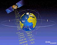
GALILEO European satellite THALES-Navigation is already involved in the development of the GALILEO European satellite-based positioning system, so plans to incorporate it into the IMAGIN technology are already in place. "We have already been involved in the specifications of GALILEO signals, and hope to be one of the first companies in the world to develop a combined GPS / GALILEO as a GALILEO prototype for the European authorities," says Pichot. Each of the project partners have taken the benefits of IMAGIN and adapted them to other niche markets, including professional offshore applications such as small and medium-scale marine surveys, and they expect their turnovers to triple as a result. This was Pichot's first EUREKA project and he was extremely impressed. "Being involved in a EUREKA project forced our company to acquire a clearer and deeper view (both technical and commercial) of a market segment which is still very new and innovative," he says. "EUREKA is an excellent initiative to develop international cooperation in innovative technological and technical areas particularly suited to application-orientated projects." Community Email This Article Comment On This Article Related Links EUREKA SpaceDaily Search SpaceDaily Subscribe To SpaceDaily Express GPS Applications, Technology and Suppliers
 Cheltenham, England (SPX) Jan 09, 2006
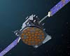
Marotta UK is pleased to announce that it designed, developed and qualified equipment for the cold gas propulsion systems on board the Galileo GIOVE-A, part of Europe's Galileo navigation program, successfully launched by Surrey Satellite Technology (SSTL). |
|
| The content herein, unless otherwise known to be public domain, are Copyright 1995-2006 - SpaceDaily.AFP and UPI Wire Stories are copyright Agence France-Presse and United Press International. ESA PortalReports are copyright European Space Agency. All NASA sourced material is public domain. Additionalcopyrights may apply in whole or part to other bona fide parties. Advertising does not imply endorsement,agreement or approval of any opinions, statements or information provided by SpaceDaily on any Web page published or hosted by SpaceDaily. Privacy Statement |