|
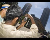
Terre Haute IN (SPX) Sep 20, 2006 When researchers from Indiana State University's Center for Urban and Environmental Change arrived at an area near East 30th Street and Cumberland Road for a field study, they saw concrete evidence of just how rapidly Indiana's capital - the nation's 12th largest city - is changing. Make that concrete, asphalt and brick evidence. A wooded area depicted in satellite images taken just three years ago has been replaced with the concrete sidewalks and driveways, asphalt streets and brick-fronted homes of a subdivision. The common construction materials are major contributors to a problem that plagues cities worldwide. By retaining heat and not allowing rain water to pass through to the soil beneath, the concrete, asphalt and brick of suburban housing developments keep cities warmer than the surrounding countryside, a phenomenon known as the urban heat island effect. Thanks to a grant from the National Science Foundation, the Indiana State researchers are looking into methods that could help large cities stay just a little bit cooler by planting trees to spread their shading branches over streets and sidewalks. In the first year of the three-year project, Qihao Weng, associate professor of geography at Indiana State and director of the Center for Urban and Environmental Change, and his students have already begun to look at other metropolitan areas in the United States, including New York; Chicago; Los Angeles; Houston; and a location that might be called an "urban super heat island," Phoenix. "Satellite images provide global coverage. By using remote-sensing measurements, we can do urban heat detection and monitoring for all major cities in the world. One of our goals is to apply the methodology we develop here in Indianapolis to other cities," Weng said. Indianapolis is planting plenty of trees these days. Officials are keeping records of each tree the city is planning and ensuring they are spaced in a way that is intended to provide the most benefit. Weng believes the layout of urban landscapes - from lawns, trees, parks and cemeteries to streets, parking lots and buildings - plays a role in determining the urban heat island effect. Indianapolis' White River State Park, for example, gently curves along the banks of its namesake. Weng has a theory that such a layout holds the key to reducing the urban heat island effect, even if by just a few degrees. "Theoretically speaking, a park with a square or rectangular shape is going to generate more heat than a park of the same total area with a circular shape because it has more heat interactions with the surrounding area of impervious surfaces," he explained. Weng's research is using Indianapolis as a pilot project to develop methods for cities worldwide to use in addressing urban heat islands. One of the first steps is field studies that verify - or, in the case of the new subdivision, correct - information gathered from satellite images and remote sensing. To do that, Weng and his students are visiting and photographing each of 350 locations throughout Marion County and comparing temperature estimates generated by remote sensing with actual weather station readings on the ground. "After we do this, we can tell the urban planning people, 'Hey, you can fix this problem by changing the shape, use or type of land cover,'" said Hua Liu, a Ph.D. student in geography." We cannot just have a huge parking lot with a huge building; we have to have some grass ... to cool the temperature down." Weng believes Indianapolis and Indiana State University are leading the way in conducting such research and developing ways to minimize the effects of urban heat islands. "We intend to develop a very comprehensive database. Other cities, to my knowledge, haven't developed this kind of comprehensive knowledge," he said. "The city Park and Recreation Department has collected a tree inventory database, and using that database, combined with our records obtained through field work, we will soon be able to develop a very comprehensive urban land cover database to use in our urban heat island studies and other kinds of urban ecosystems studies in the future." Community Email This Article Comment On This Article Related Links Indiana State University Learn about Climate Science at TerraDaily.com Climate Science News - Modeling, Mitigation Adaptation
 Virginia Key FL (SPX) Sep 20, 2006
A few years ago, chemical analyses of deep sea muds that used a new X-ray technology were able to help explain why the Classic Mayan civilization collapsed more than a thousand years ago. At the University of Miami Rosenstiel School of Marine and Atmospheric Science, a new tool will apply a similar technology to find answers to historic climate changes from earth and marine sediment core samples. |
|
| The content herein, unless otherwise known to be public domain, are Copyright 1995-2006 - SpaceDaily.AFP and UPI Wire Stories are copyright Agence France-Presse and United Press International. ESA PortalReports are copyright European Space Agency. All NASA sourced material is public domain. Additionalcopyrights may apply in whole or part to other bona fide parties. Advertising does not imply endorsement,agreement or approval of any opinions, statements or information provided by SpaceDaily on any Web page published or hosted by SpaceDaily. Privacy Statement |