|
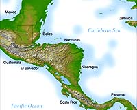
Huntsville AL (SPX) Oct 03, 2005 A thousand years ago, Mayan civilization collapsed. Today, a Space Age "situation room" in Panama is helping Central Americans avoid mistakes that doomed the Maya. September 29, 2005: Central America, that narrow land bridge between North and South America, represents less than 0.5 percent of Earth's land mass. But it is home to 7 or 8 percent of the world's species of plants and animals. That rain forest home, however, is assaulted by both nature and man: earthquakes, hurricanes, illegal logging and ranching, and deforestation from slash-and-burn agriculture. Now, NASA scientists are helping Central America keep watch on its biological treasures and stop environmental depredations through SERVIR, an acronym standing for the Spanish words meaning Mesoamerican Regional Visualization and Monitoring System. SERVIR is not a satellite. Instead, it's a "situation room" or "nerve center," which opened in Panama in February 2005. There, scientists use a whole constellation of existing NASA, commercial and international satellites observing Earth at visible, infrared, and radar wavelengths. They combine satellite data with ground observations, and speed the results to national leaders, who then can make informed political decisions about environmental management or disaster response. For example, "every year there are terrible fires across Central America because of slash-and-burn agriculture," says Dan Irwin, SERVIR project manager at NASA's Marshall Space Flight Center. Such fires used to rage out of control�until two years ago, when Irwin and other SERVIR partners invented a system for identifying "fire hotspot pixels" on satellite images. Today SERVIR's fully-automated fire detection system notifies field teams and rapidly guides them to the site using GPS. Firefighters can reach a fire (often in a remote area) and fight it while it is still containable. This kind of environmental monitoring is important to a region that has seen the collapse of at least one grand civilization, that of the Maya. There's mounting archeological evidence that the once proud Mayan civilization, with 10 million citizens throughout Mesoamerica a thousand years ago, may have been due to colossal environmental foolishness. "The Maya had totally destroyed their forests," Irwin explains. "That deforestation and local climatic conditions, we believe, led to such a severe drought that ... the entire Maya culture disappeared in just a few years." If only the Maya had had had SERVIR. The system is able to monitor deforestation, drought and much more. Recently, SERVIR revealed its power to pinpoint red tides--harmful blooms of red algae that periodically overspread parts of the Atlantic and Pacific oceans on either side of Central America, poisoning fish Historically, red tides have cost local fishing industries millions of dollars a year, because customers become scared to eat any ocean fish at all. But using data from the Aqua satellite, a team from SERVIR "figured out how to identify the exact locations of a bloom," Irwin says. When a red tide struck off the coast of El Salvador in June 2004, "an environmental official was shown eating fish on TV, to demonstrate that fish caught outside a red tide was still safe�and that SERVIR showed where it was still safe to fish," he says. "We were thrilled!" SERVIR also does weather. "Central American nations often cannot afford the weather radar systems common in United States," says Irwin. So, SERVIR has joined forces with the NASA Short-term Prediction Research and Transition Center (SPoRT) to forecast weather 24 hours in advance using a computer-model that takes into account precipitation, wind speed, temperature, and dew point. "The SERVIR forecasts are so popular they're even being used for weather predictions on Central American TV news." The origins of SERVIR can be traced as far back as 1986 when Irwin's colleague Tom Sever, NASA's only archaeologist, acquired a satellite image of northern Guatemala to examine it for archaeological sites. As soon as he glanced at the image, Sever "was stunned that he could see the political border between Guatemala and Mexico, because of the deforestation in Mexico," Irwin recalls.
Above: The razor-sharp border between Mexico and Guatemala, as seen in this 1988 Landsat image, shows the impact of rural settlements on the rainforest. The image was so powerful, it was published in National Geographic magazine, and became a catalyst for the president and congress of Guatemala to set up what they call the Mayan Biosphere Reserve�Guatemala's largest protected area. The Mayan Biosphere Reserve led, in turn, to the creation of something even bigger: the Mesoamerican Biological Corridor, an environmental greenway the length of Central America, connecting parks and preserves among all Central American nations. NASA has helped monitor this so-called "biocorridor" from space, primarily from 1999 to 2002. "I came to NASA to work with Sever on that project," Irwin recalls. 2002 was a key year in the development of SERVIR. That was when Irwin attended a meeting with the environment ministers of all countries, who said they wanted an integrated system to produce information not only on the forests, but also on the oceans. Right: Dan Irwin in Central America. "I envisioned a 'dashboard' of environmental-monitoring capabilities," says Irwin. Just as a dashboard of a car brings together information from all over the vehicle, so would SERVIR gather information from many satellites and sensors. "The U.S. Agency for International Development and The World Bank offered funding, and we've teamed with these groups to make SERVIR a reality." SERVIR's approach could take over the world. Its operations are serving as a model for NOAA's Global Earth Observation System of Systems (GEOSS). GEOSS is seeking to be for the entire world what SERVIR is for Central America�a clearinghouse for combining data from the myriad of Earth-observation satellites in the sky�as well as ground based and other data�to provide useful, customized information fast to decision-makers worldwide. The dramatic lesson from the Maya is clear for Irwin: "The idea behind SERVIR, and GEOSS, is not to repeat the mistakes of the past." Community Email This Article Comment On This Article Related Links SpaceDaily Search SpaceDaily Subscribe To SpaceDaily Express Earth Observation News - Suppiliers, Technology and Application
 New York NY (SPX) Jan 11, 2006
The importance of remotely sensed data and technologies to support natural disasters has prompted attention and action in Washington. New initiatives and legislation authorizing appropriations to the remote sensing industry will be discussed at Strategic Research Institute's U.S. Commercial Remote Sensing Industry conference, scheduled for February 9-10, 2006 in Washington D.C. |
|
| The content herein, unless otherwise known to be public domain, are Copyright 1995-2006 - SpaceDaily.AFP and UPI Wire Stories are copyright Agence France-Presse and United Press International. ESA PortalReports are copyright European Space Agency. All NASA sourced material is public domain. Additionalcopyrights may apply in whole or part to other bona fide parties. Advertising does not imply endorsement,agreement or approval of any opinions, statements or information provided by SpaceDaily on any Web page published or hosted by SpaceDaily. Privacy Statement |