|
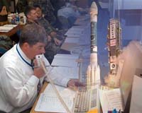
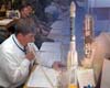
50th Space Wing Public Affairs Schriever AFB (AFNS) Oct 02, 2006 Airmen from the 1st Space Operations Squadron here assumed launch and early orbit responsibilities for Global Positioning System IIR-M 15 shortly after it lifted off Sept. 25 from Cape Canaveral Air Force Station, Fla. The satellite's journey of 11,000 miles began as its Delta II rocket lifted off a year to the day after the launch of GPS IIR-M 14 in 2005. GPS IIR-M 15 will provide two military signal bands and two civil bands. Its signal strength is two to four times more powerful than GPS Block II satellites launched less than 10 years ago, making the satellite more resistant to jamming, said Willard Marquis, a staff engineer with Lockheed Martin. "People with GPS receivers don't get a signal strength, but they know whether the signal is corrupted," Mr. Marquis said. "You're more likely to get a signal from a Block IIR-M satellite near the horizon or in woods than you'd be with earlier satellites." The military bands on GPS IIR-M 14 and 15 are currently in use for development purposes -- they broadcast a signal, but for the moment, the signal does not carry any data, Mr. Marquis said. The squadron is the only one of its kind in Air Force Space Command. The 1st SOPS supports GPS; participates in the Midcourse Space Experiment, a NASA research and development program; and collects booster telemetry. "We support the 2nd Space Operations Squadron's GPS mission, and we have a couple of GPS satellites of our own," said Lt. Col. Craig Bomberg, 1st SOPS commander. "We took over after booster separation, and we'll hand the satellite over to 2nd SOPS next week." The handover will occur after 1st SOPS Airmen and contractors have maneuvered the GPS satellite into its permanent orbit, a route that carries it around the Earth every 12 hours. The Air Force Satellite Control Network, operated by 22nd SOPS here, also supported the Delta II launch through its tracking stations at Guam and Hawaii. Satellites typically lose telemetry contact with the ground during the turbulent launch process. The 22nd SOPS detachment at the Guam Tracking Station received a signal from the booster approximately one hour after launch. The satellite then separated from the rocket and was acquired for the first time approximately 15 minutes later at Kaena Point Tracking Station in Hawaii. GPS provides 24-hour precision navigation and timing services to civil and military users. It provides combat capability to servicemembers overseas in applications such as joint direct attack munitions and handheld receivers. Civilian applications include automatic tellers and bank and stock market transactions. GPS first became available at full capacity in April 1995.
Source: US Departmanent of Defense Community Email This Article Comment On This Article Related Links GPS Applications, Technology and Suppliers GPS Applications, Technology and Suppliers
 Schriever AFB CO (SPX) Sep 28, 2006
A team of Airmen, civil servants and contractors with the 1st Space Operations Squadron here assumed launch and early orbit responsibilities for Global Positioning System IIR-M 15 shortly after it lifted off from Cape Canaveral Air Force Station, Fla. Sept.25. |
|
| The content herein, unless otherwise known to be public domain, are Copyright 1995-2006 - SpaceDaily.AFP and UPI Wire Stories are copyright Agence France-Presse and United Press International. ESA PortalReports are copyright European Space Agency. All NASA sourced material is public domain. Additionalcopyrights may apply in whole or part to other bona fide parties. Advertising does not imply endorsement,agreement or approval of any opinions, statements or information provided by SpaceDaily on any Web page published or hosted by SpaceDaily. Privacy Statement |