|
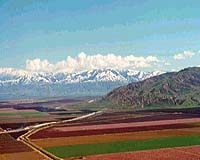
Calgary - Feb 6, 2002 CSI Wireless Inc has begun marketing its new "SERES" high-performance positioning product: a combined GPS/SBAS receiver and antenna system for Precision Agriculture, GIS & Mapping, and other markets. CSI Wireless also announced it has already received an $850,000 purchase order for the SERES from a U.S. firm. "We will begin delivering to this initial U.S. customer by mid February," said Stephen Verhoeff, CSI Wireless' President and CEO. Several other potential customers are testing the product. We're very pleased to see a lot of interest in the SERES from several markets, including Precision Agriculture and GIS & Mapping." The self-contained SERES receives free location-determining signals from the U.S. government's Global Positioning System (GPS), and receives free accuracy-enhancing signals from the U.S. government's Wide Area Augmentation System (WAAS). SERES can also receive accuracy-enhancing signals from two WAAS-like systems -- the European Geostationary Navigation Overlay System (EGNOS), and Japan's MTSAT Satellite-based Augmentation System (MSAS) -- that are under development. WAAS, EGNOS and MSAS are compatible with each other, and collectively known as Space Based Augmentation Systems (SBAS). SERES can also receive more accuracy-enhancing data from other sources via its dual communication ports. In the Precision Agriculture market, the most popular role for the SERES will be as the positioning tool of a larger precision guidance system, typically installed on the roof of a sprayer vehicle. In the GIS & Mapping market, the SERES will usually be mounted on a backpack equipped with an antenna pole to provide precise position data to a hand-held data collector. SERES features CSI Wireless' patent-pending e-Dif technology, which permits users to operate for up to 40 minutes without requiring accuracy- enhancing services, while providing sub-meter accuracies initially. SERES also features CSI Wireless' exclusive COAST technology. COAST, similar to e- Dif, enables the receiver to use old correction data for up to 40 minutes without seriously degrading accuracy. e-Dif and COAST make SERES less likely than competing products to be affected by blocked signals, which occur when trees, buildings or other obstacles temporarily block signals from reaching receivers. No competing product offers this flexibility. The SERES -- nick-named the "smart antenna" because it houses not only the antenna but the microprocessor or "brains" with which to compute positions -- combines consistent high accuracy with quick start-up and signal- acquisition capabilities. It achieves sub-meter positioning accuracy when employing SBAS corrections, and features start-up times of typically 35 seconds, or only 15 seconds if the system has been on anytime in the previous two hours. The SERES is very easy to install and operate because it uses a single power and data cable, whereas competing products feature separate receivers and antennas, and often require three or more cables for power input, antenna signal, and data distribution signals. SBAS includes WAAS -- which is already being used for a wide range of applications, but undergoing final testing for aviation use -- plus compatible services (EGNOS in Europe and MSAS in Japan). All three broadcast signals from their proprietary satellites. The signals provide more accuracy-enhancing data than what is available via other differential services such as radiobeacon stations. SBAS can be also used over a much wider area, with more consistent performance. Community Email This Article Comment On This Article Related Links CSI Wireless Inc SpaceDaily Search SpaceDaily Subscribe To SpaceDaily Express GPS Applications, Technology and Suppliers
 Cheltenham, England (SPX) Jan 09, 2006
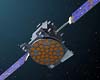
Marotta UK is pleased to announce that it designed, developed and qualified equipment for the cold gas propulsion systems on board the Galileo GIOVE-A, part of Europe's Galileo navigation program, successfully launched by Surrey Satellite Technology (SSTL). |
|
| The content herein, unless otherwise known to be public domain, are Copyright 1995-2006 - SpaceDaily.AFP and UPI Wire Stories are copyright Agence France-Presse and United Press International. ESA PortalReports are copyright European Space Agency. All NASA sourced material is public domain. Additionalcopyrights may apply in whole or part to other bona fide parties. Advertising does not imply endorsement,agreement or approval of any opinions, statements or information provided by SpaceDaily on any Web page published or hosted by SpaceDaily. Privacy Statement |