|
Moscow, Russia (RIA Novosti) Nov 22, 2006 Russia's global positioning system Glonass should be extended to cover the whole country by the end of 2007, the Russian defense minister said Wednesday. Glonass, a Russian version of the U.S. Global Positioning System (GPS), is designed for both military and civilian purposes, and allows users around the globe to identify their positions in real time. It can also be used in geological prospecting. "By the end of 2007, we should ensure the system's operation throughout Russia's territory," said Sergei Ivanov, also a deputy prime minister, at a meeting with the governor of Siberia's Krasnoyarsk Territory. Ivanov told Alexander Khloponin that his region plays a key role in this program, as it is home to KB Reshetneva, a leading manufacturer of spacecraft with a long service life. Russia said last week it will lift all precision restrictions, from the start of 2007, in the use of military-controlled Glonass to enable accurate and unlimited commercial use of the global positioning system. Current restrictions limit the accuracy for civilian users of Glonass to 30 meters. The Russian Space Agency approved the Russian military's decision to put the system into commercial use. "We think that canceling restrictions for all Russian citizens using Glonass signals opens unlimited opportunities, and we will encourage the development of the new and promising market of satellite navigation," agency spokesman Igor Panarin said. He said that Glonass services would be a luxury for most people in Russia to begin with. "But with time, every housewife will be able to place a portable satellite navigator on her dog's collar so that she can know where her pet is at any given moment."
Source: RIA Novosti Community Email This Article Comment On This Article Related Links All about the technology of space and more GPS Applications, Technology and Suppliers GPS Applications, Technology and Suppliers
 Oberpfaffenhofen, Germany (SPX) Nov 22, 2006
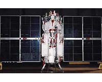
The foundation stone was laid yesterday at the German Aerospace Center (DLR) establishment in Oberpfaffenhofen for the new control centre for Europe's Galileo satellite navigation system. The first official step in the construction of the ground segment for the high-precision European navigation system was taken in the presence of the Federal Minister of Transport, Building and Urban Affairs, Wolfgang Tiefensee, the Bavarian Minister-President, Dr. Edmund Stoiber, and the Chairman of DLR, Prof. Dr Sigmar Wittig. |
|
| The content herein, unless otherwise known to be public domain, are Copyright 1995-2006 - SpaceDaily.AFP and UPI Wire Stories are copyright Agence France-Presse and United Press International. ESA PortalReports are copyright European Space Agency. All NASA sourced material is public domain. Additionalcopyrights may apply in whole or part to other bona fide parties. Advertising does not imply endorsement,agreement or approval of any opinions, statements or information provided by SpaceDaily on any Web page published or hosted by SpaceDaily. Privacy Statement |