|
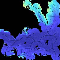
Troy NY (SPX) Nov 01, 2005 A Rensselaer researcher has been awarded $845,000 in federal funding to create improved computer representations of terrain on the surface of the Earth and beyond. The research could have a variety of both military and civilian applications, from strategically positioning soldiers to placing radio towers on the moon. "I'm studying better ways to compress the massive amounts of terrain data now available from radar and laser scans of the Earth's surface," says W. Randolph Franklin, associate professor of electrical, computer, and systems engineering at Rensselaer Polytechnic Institute and principal investigator for the project, which is funded by the Defense Advanced Research Projects Agency (DARPA). Current methods often produce unacceptable terrain maps, giving rise to errors that are clearly visible in any commercial mapping product, according to Franklin. For example, one common mapping software renders Niagara Falls as a gentle slope, while another has 50-foot elevation contours crossing a shoreline. The program funding Franklin's work -- called Geo*, for GeoSpatial Representation and Analysis -- exists because effective support for military operations requires better ways to represent Earth's surface. A specific focus is on the need to improve navigation of unmanned aerial vehicles (UAVs). "I will be researching and developing three different terrain representations," Franklin says. "I will also be studying some important applications of terrain data." One application is geared toward identifying the best sites to position a group of soldiers to allow them to see as much terrain as possible. Such a technology could also have civilian uses, such as in placing cell phone towers or locating visual nuisances where they would be the least visible. "A far-out application for radio towers would occur when the moon or Mars are settled," Franklin says. "Both have no ionosphere to enable long-distance radio, and the moon has no stable satellite orbits for potential communication satellites." He suggests that ground-based radio relays, visible to each other, could be the best way to communicate on these surfaces. DARPA is the central research and development organization for the Department of Defense (DOD). It manages and directs selected basic and applied research and development projects for DOD, and pursues research and technology where risk and payoff are both very high and where success may provide dramatic advances for traditional military roles and missions. Community Email This Article Comment On This Article Related Links SpaceDaily Search SpaceDaily Subscribe To SpaceDaily Express Earth Observation News - Suppiliers, Technology and Application
 New York NY (SPX) Jan 11, 2006
The importance of remotely sensed data and technologies to support natural disasters has prompted attention and action in Washington. New initiatives and legislation authorizing appropriations to the remote sensing industry will be discussed at Strategic Research Institute's U.S. Commercial Remote Sensing Industry conference, scheduled for February 9-10, 2006 in Washington D.C. |
|
| The content herein, unless otherwise known to be public domain, are Copyright 1995-2006 - SpaceDaily.AFP and UPI Wire Stories are copyright Agence France-Presse and United Press International. ESA PortalReports are copyright European Space Agency. All NASA sourced material is public domain. Additionalcopyrights may apply in whole or part to other bona fide parties. Advertising does not imply endorsement,agreement or approval of any opinions, statements or information provided by SpaceDaily on any Web page published or hosted by SpaceDaily. Privacy Statement |