|
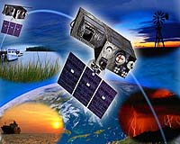
Redondo Beach CA (SPX) Oct 31, 2005 Northrop Grumman and its teammate Raytheon have won a program definition and risk reduction contract for the nation's next-generation Geostationary Operational Environmental Satellite (GOES) system, GOES-R. The contract was awarded by the National Oceanic and Atmospheric Administration (NOAA). The $10 million, six-month contract includes options for a potential additional $20 million and a 16-month extension. During the program definition and risk reduction phase, the team will produce trade studies comparing the performance and cost of alternative system architectures, develop system definition through allocating requirements and operational functions, initiate system and segment designs for products to be developed in the subsequent program phase, execute steps to reduce key risk areas and demonstrate the team's ability to meet the government's end-to-end system performance requirements for NOAA's missions. "The GOES system has been an essential cornerstone of weather observations and forecasting for 25 years," said Alexis Livanos, president of Northrop Grumman's Space Technology sector. "Our team will draw on its years of expertise in design, development and integration of large complex environmental systems to create an affordable program that places greatly improved data into the user's hands." Northrop Grumman and Raytheon have extensive experience in building and integrating remote sensing spacecraft, and managing high-volume command, control and data systems. Just recently, NASA's Northrop Grumman-built Aqua spacecraft contributed to prediction and disaster-relief efforts to all of the recent hurricanes by providing authorities with data on sea surface temperatures, rainfall and flooding. GOES-R will collect 100 times more data and scan the Earth three-to-five times faster than previous systems, providing improved spatial, spectral and temporal resolution. These advances will provide more advanced environmental products and services that can be used by weather forecasters for many applications, including hurricane track and intensity forecasts and monitoring of coastal, harbor and inland waterways for fishing, contamination and environmental change analysis. Improved products and services are critical to NOAA's missions for monitoring weather and water, climate, oceans and ecosystems, and commerce and transportation. Community Email This Article Comment On This Article Related Links SpaceDaily Search SpaceDaily Subscribe To SpaceDaily Express Weather News at TerraDaily.com
 London UK (SPX) Dec 23, 2005
This week's launch of MSG-2 will ensure that satellite images continue to be available to European weather forecasters well into the next decade. It also marks a new chapter in a long-term space experiment measuring the available energy that drives the weather as a whole, and helping to establish how much the Earth is heating up. |
|
| The content herein, unless otherwise known to be public domain, are Copyright 1995-2006 - SpaceDaily.AFP and UPI Wire Stories are copyright Agence France-Presse and United Press International. ESA PortalReports are copyright European Space Agency. All NASA sourced material is public domain. Additionalcopyrights may apply in whole or part to other bona fide parties. Advertising does not imply endorsement,agreement or approval of any opinions, statements or information provided by SpaceDaily on any Web page published or hosted by SpaceDaily. Privacy Statement |