|
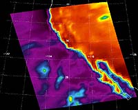
West Lafayette (SPX) May 04, 2004 Purdue has been selected to be one of the country's four top-level distributors of advanced weather data, making the university a national resource for meteorologists, hydrologists, aviators and disaster management teams. Citing Purdue's experience with both atmospheric science and handling large data sets, the National Oceanic and Atmospheric Administration (NOAA) has chosen the university to distribute advanced Next Generation Radar data on rainfall and wind. The service, which will provide recipients with three-dimensional pictures of weather systems in real time, is part of NOAA's new method of sharing data that is intended to provide useful, high-resolution weather information to the world faster and more efficiently than before. NOAA will now entrust Purdue with the maintenance of a 24-hour, high-speed stream of data, which private organizations can access via the Internet. "This service could be a big step forward in protecting lives and property from severe weather," said Matthew Huber, assistant professor of earth and atmospheric sciences in Purdue's School of Science. "This radar data will be a primary resource for anyone, such as meteorologists at television stations and airports, who wants a complete picture of U.S. weather." Along with two other institutions, the University of Oklahoma and the Education and Research Consortium of the Western Carolinas, Purdue will provide data from the Next Generation Radar (NEXRAD), also known as the WSR-88D. A fourth site, the National Weather Service's Telecommunication Operations Center, also will make the data available if there is sufficient interest from the commercial sector. More than 120 NEXRADs at different sites will contribute what is known as "level 2" Doppler radar information to the data stream, together providing a more complete profile of the nation's weather. All three institutions have agreed to make level 2 data available to all private-sector users equally on a cost-recovery basis without restriction on redistribution or use. "Level 2 data will enable a weather analyst to peer inside storms with unprecedented clarity," Huber said. "Before now, a private-sector meteorologist looking at weather radar data could only hope for a two-dimensional view of atmospheric events that would arrive after a substantial time delay. With level 2 data, that same person will now be able to see all three dimensions in real time. For storm prediction and analysis, this improvement in capability is enormous." Opportunities for using the data stream are not limited to the media outlets with which most people are familiar, Huber said. "There is an increasing demand for this data by the private sector," he said. "Given the concern with national security, a growing number of companies are offering threat response services to the community. For example, if you are sending a response team -- firemen, hazardous materials handlers, the National Guard -- to work in a tough outdoor situation, you want to know what sort of environmental hazards they will run into. These companies can analyze level 2 Doppler radar data and help a team plan better for its task." The four providers will distribute the weather data via peer-to-peer networking, which can be compared to file sharing on the Internet. But in this case, the data sets are very large and are to be transferred without interruption, 24 hours a day. "This is one of the reasons Purdue is a good choice as a distribution point," Huber said. "We will be transferring 2.5 terabytes, the equivalent of about 3,700 CD-ROMs, each day. Purdue's experience with information technology makes this a reliable place from which to stream data." Distribution will be handled with the assistance of Information Technology at Purdue, which is providing a fast network connection, dependable service and decades of experience in high-performance computing, networking and data storage to the project. The earth and atmospheric sciences department will contribute its expertise in analyzing large data sets and in using Doppler radar data to study weather phenomena. "The partnership between Information Technology at Purdue and the department will allow both to leverage their strengths," Huber said. "It will allow us to make available a unique product." Purdue's Robert (Jeff) Trapp said he was excited about using the data for his classroom as well as his research. "We are immensely excited about our ability now to fully engage our students in the real-time usage of this valuable data stream," said Trapp, scientific supervisor for this project and associate professor of earth and atmospheric sciences. "It will serve as an exceptional learning tool and will be well integrated into our graduate and undergraduate curriculum." Doppler weather radar has been and will continue to be used extensively by Trapp and others in research studies of severe thunderstorms, tornadoes and other hazardous weather phenomena. The radar data also will be applied in new ways in the context of multidisciplinary, campuswide initiatives in climate change and computational science. Community Email This Article Comment On This Article Related Links Purdue Level II Radar Data Site SpaceDaily Search SpaceDaily Subscribe To SpaceDaily Express Earth Observation News - Suppiliers, Technology and Application
 Bangalore, India (AFP) Jun 05, 2005
Prashant Goswami at this time of year has farmers, government officials, global investors, stock market players and economists hanging on his every word -- provided he's making monsoon talk. |
|
| The content herein, unless otherwise known to be public domain, are Copyright 1995-2006 - SpaceDaily.AFP and UPI Wire Stories are copyright Agence France-Presse and United Press International. ESA PortalReports are copyright European Space Agency. All NASA sourced material is public domain. Additionalcopyrights may apply in whole or part to other bona fide parties. Advertising does not imply endorsement,agreement or approval of any opinions, statements or information provided by SpaceDaily on any Web page published or hosted by SpaceDaily. Privacy Statement |