|
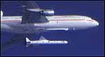
Dulles, USA - September 4, 1997 - Orbital Imaging Corporation, the Earth imaging subsidiary of Orbital Sciences Corporation, announced today its OrbView-2 satellite successfully reached operational orbit and collected its first test images of Earth. OrbView-2 was launched August 1, 1997, aboard Orbital's Pegasus XL launch vehicle. Pegasus deployed the OrbView-2 spacecraft into a circular "parking' orbit of 310 kilometers. Over August, Orbimage conducted an extensive series of spacecraft tests and determined that the satellite's operating systems are performing well. During this same period, the Orbimage ground team successfully commanded the OrbView-2 spacecraft to raise its orbit to an altitude of 705 kilometers through a series of 32 separate firings of the satellite's onboard hydrazine thrusters. Today, Orbimage successfully activated the SeaWiFS sensor carried by the OrbView-2 and collected test images of the United States and the Atlantic, and transmitted these images to the main satellite control and image processing center at Dulles, VA. With these milestones achieved, the OrbView-2 satellite is ready to commence its mission providing multi-spectral (color) images of the Earth's oceans and land surfaces for use in scientific and commercial applications. These applications include supporting the National Aeronautics and Space Administration's (NASA) Mission to Planet Earth initiative. NASA will use OrbView-2 imagery to better understand the Earth's carbon cycle processes and their effect on global warming trends. Commercially, Orbimage will market the multi-spectral imagery to organizations involved in environmental monitoring, alongw ith fisheries, forestry and agricultural applications. During September, the onboard SeaWiFS instrument will continue to produce test imagery that will be introduced to commercial markets and the scientific community in early October.
During the next several years, Orbimage plans to operate three satellites that perform separate missions. Orbimage currently operates OrbView-1, a commercial atmospheric monitoring satellite launched in 1995. Initial phases of construction for OrbView-3, the third in Orbimage's satellite family, have already begun, with an expected in-service date of approximately two years from now. OrbView-3 is designed to provide high-quality, one meter resolution and hyperspectral digital images of the Earth's land surfaces. Email This Article Comment On This Article Related Links Space
 Calcutta, India (SPX) Dec 28, 2005
The successful launch Thursday of India's heaviest satellite from spaceport of Kourou in French Guyana may have boosted the country's space research efforts to yet another level, but it has also lifted the spirits of at least three Direct-To-Home televisions broadcasters, one of which has been waiting for years to launch its services in India. |
|
|
|
|
|
|
|
|
|
|
|
|
|
| The content herein, unless otherwise known to be public domain, are Copyright 1995-2006 - SpaceDaily.AFP and UPI Wire Stories are copyright Agence France-Presse and United Press International. ESA PortalReports are copyright European Space Agency. All NASA sourced material is public domain. Additionalcopyrights may apply in whole or part to other bona fide parties. Advertising does not imply endorsement,agreement or approval of any opinions, statements or information provided by SpaceDaily on any Web page published or hosted by SpaceDaily. Privacy Statement |