|
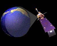
Washington DC (SPX) Jun 19, 2007 With an active Atlantic hurricane season expected for 2007, NOAA's high-powered satellites are ready to send forecasters a steady stream of crisp, detailed images, and other important data, of any storm that develops in the Western Hemisphere. The NOAA Satellite and Information Service operates a fleet of spacecraft that monitor the weather, including conditions that trigger hurricanes and the tornadoes and floods that accompany them. "These satellites often provide us with the first indication that a storm is forming and they play an important role in predicting where a storm will go," said Mary Kicza, assistant administrator for NESDIS. NOAA's Geostationary Operational Environmental Satellites (GOES), which operate from a fixed position 22,500 miles above the east and west coasts, take constant images of hurricanes and track their movement. Additionally, NOAA's Polar-orbiting Operational Environmental Satellites (POES), which operate 530 miles over the Earth, orbiting the entire planet, keep an eye on storms, while providing data - including sea-surface temperatures, which is incorporated into global weather models. Satellite data is used in combination with hurricane buoys, hurricane hunter aircraft, air-borne Doppler radar, dropwindsondes, and the experience and skill of NOAA's forecasters to predict tropical storm impacts. "Our satellites are in good health and are closely watching the oceans for any hint of tropical storm activity," Kicza added. "Our top priority is to provide the satellite images and data to NOAA meteorologists, who make the forecasts that enable emergency managers to help people get out of harm's way."
NOAA Satellite Fleet NOAA also has five polar-orbiting satellites - two that are operational, including a spacecraft in a joint venture with Europe, with three more serving as backup satellites. POES are key in monitoring changes in the atmosphere and ocean temperatures and climate phenomena, such as El Nino and La Nina. "We have an elaborate system in place, including back-up satellites and partnerships with other nations, that would handle any hiccups and keep monitoring storms," said Kathy Kelly, director of the NOAA Satellite Operations and Satellite Data Processing and Distribution. Additionally, NESDIS processes data from other spacecraft, such as NASA's research QuikSCAT satellite, which is used in hurricane forecast models. "Our forecasters are using research tools like QuickSCAT to develop enhanced forecast models," said Mary Glackin, acting director of the NOAA National Weather Service. "NOAA's satellites are a key component to accurate hurricane forecasts, but our focus on next-generation technologies will ensure continued to improvement in hurricane services." Just last week, NOAA officially dedicated a new home for its around-the-clock environmental satellite operations. The NOAA Satellite Operations Facility, in Suitland, Md., supports a range of high-technology equipment, including 16 antennas that control more than $4.7 billion worth of environmental satellites. Each day, NSOF processes more than 16 billion bytes of environmental data from NOAA's satellites and the Department of Defense's Meteorological Satellite Program.
NOAA Satellites Show Moxie In New Orleans, ground zero for Hurricane Katrina, the costliest hurricane in U.S. history, GOES sent 716 images of the storm between August 26 and August 30. "During Katrina, nothing could have been more helpful to forecasters than [NOAA] GOES imagery," said Paul Trotter, meteorologist in charge of the NOAA National Weather Service forecast office in Slidell, La. "In areas where observations were limited, satellite imagery of the southwest movement of Katrina, once it began to move through and exit Florida, gave tremendous lead time of the eventual curve toward southeast Louisiana."
Future NOAA Satellites "Since the first GOES satellite began monitoring the weather in 1975, we have never stopped trying to make this system better," Kicza said. Also planned for the future is the National Polar-orbiting Operational Environmental Satellite System, or NPOESS. This satellite system also will bring improved data and imagery for better weather forecasts, severe-weather monitoring and detection of climate change. Email This Article
Related Links
 Paris, France (ESA) Jun 19, 2007
ESA and Thales Alenia Space have signed a 229 million euro contract for the design and development of Sentinel-1, the first Earth observation satellite to be built for Europe's Global Monitoring for Environment and Security (GMES) programme. ESA's Director General, Jean-Jacques Dordain, and President and CEO of Thales Alenia Space, Pascale Sourisse, signed the contract on behalf of the Italian branch of the company Monday at the International Paris Air Show Le Bourget. |
|
| The content herein, unless otherwise known to be public domain, are Copyright 1995-2006 - SpaceDaily.AFP and UPI Wire Stories are copyright Agence France-Presse and United Press International. ESA PortalReports are copyright European Space Agency. All NASA sourced material is public domain. Additionalcopyrights may apply in whole or part to other bona fide parties. Advertising does not imply endorsement,agreement or approval of any opinions, statements or information provided by SpaceDaily on any Web page published or hosted by SpaceDaily. Privacy Statement |