|
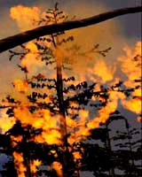
Pasadena - Aug 21, 2003 If a forest catches fire and no one is around to see it, can it call for help? The forest cannot call, but thanks to new technology developed by NASA, firefighters may get the word faster through new, high-tech eyes in the sky. New software developed by NASA's Jet Propulsion Laboratory, Pasadena, Calif., helps link NASA's Earth science satellites together to form a virtual web of sensors with the ability to monitor the globe far better than individual satellites. An imaging instrument flying on one satellite can detect a fire or other hazard, and automatically instruct a different satellite that has the ability to take more detailed pictures to take a closer look. If the images show that a potential hazard does exist, the responding satellite provides data to ground controllers, who then report the fire to forest officials and to an interested science team. "Essentially, we are adding the response mechanism to the detection process," said Dr. Steve Chien, JPL principal scientist in artificial intelligence. "This is a first step to enabling users of satellite remote sensing data to specify the kind of data they want, such as forest fires or floods, rather than the traditional request to, say, look at northern Montana." One of the core components in this collaborative effort is the Science Goal Monitor system being developed at NASA's Goddard Space Flight Center, Greenbelt, Md. The system enables scientists to specify what to look for and how to react in descriptive rather than technical terms. Then the system monitors science streams of data to identify occurrences of the key events previously specified by the scientist. "When an event occurs, the system autonomously coordinates the execution of the scientist's desired reactions between different observatories or satellites," said Jeremy Jones, Goddard's task leader for the monitor system. "This is designed to be adaptable to many different types of phenomena and supports a wide variety of sensor web configurations." Using the sensor web method, investigators no longer have to rely on after-the-fact data analysis to determine what happened. The information can be used to rapidly respond to hazardous events such as forest fires. For example, moderate-resolution imaging instruments that fly on both NASA's Terra and Aqua spacecraft observe the entire globe every day. The instruments' data is automatically processed on the ground within hours of acquisition by the Rapidfire Center at the University of Maryland, College Park. If this processing detects a hot spot, scientific criteria can be used to automatically redirect the Earth Observing 1 satellite to provide high-resolution images. When that information comes back to a scientist for interpretation, it is made available to forest officials to determine the appropriate response. All this can happen in 24 to 48 hours, compared to a typical lead time of 14 days for preplanned observations. The satellite sensor web demonstration is a collaborative effort between JPL and the Goddard Space Flight Center. The Rapidfire Center is led by Dr. Chris Justice. Community Email This Article Comment On This Article Related Links SpaceDaily Search SpaceDaily Subscribe To SpaceDaily Express Earth Observation News - Suppiliers, Technology and Application
 New York NY (SPX) Jan 11, 2006
The importance of remotely sensed data and technologies to support natural disasters has prompted attention and action in Washington. New initiatives and legislation authorizing appropriations to the remote sensing industry will be discussed at Strategic Research Institute's U.S. Commercial Remote Sensing Industry conference, scheduled for February 9-10, 2006 in Washington D.C. |
|
| The content herein, unless otherwise known to be public domain, are Copyright 1995-2006 - SpaceDaily.AFP and UPI Wire Stories are copyright Agence France-Presse and United Press International. ESA PortalReports are copyright European Space Agency. All NASA sourced material is public domain. Additionalcopyrights may apply in whole or part to other bona fide parties. Advertising does not imply endorsement,agreement or approval of any opinions, statements or information provided by SpaceDaily on any Web page published or hosted by SpaceDaily. Privacy Statement |