|
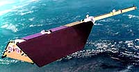
Pasadena - May 15, 2002 A new, cost-effective technology based on the venerable global positioning system (GPS) may soon revolutionize the way Earth's atmosphere is monitored. Scientists at NASA's Jet Propulsion Laboratory, Pasadena, Calif., are excited by early analysis of data from their prototype instruments aboard two international scientific spacecraft in low Earth orbit. Blackjack GPS receivers aboard the German Challenging Minisatellite Payload, or "Champ," and the Argentine Satelite de Aplicaciones Cientificas-C (Scientific Applications Satellite), fitted with special antennas that focus on Earth's horizon, are tracking the radio signals broadcast by each of the 28 high-orbiting global positioning system satellites as they rise and set on Earth's horizon. The process is called GPS limb sounding (also known as GPS occultation). By measuring--to within a few trillionths of a second--the subtle changes in the time it takes for the global positioning system signals to arrive at the spacecraft as they travel through Earth's atmosphere, scientists can derive a surprising amount of data. These data include extremely precise profiles of atmospheric density, pressure, temperature and moisture content. Additional analysis can yield global pressure contour maps, critical climate variables and even the stratospheric wind fields that affect airline routes. Preliminary evaluations indicate this technology will be applicable to fields as diverse as weather prediction and climate research, Sun-Earth interaction research, solid Earth dynamics and oceanography. It may also be used to create the first 3-D images of Earth's ionosphere, a turbulent and mysterious shroud of charged particles that, when stimulated by solar flares, can disrupt communications around the world. "GPS occultation is a novel, cost-effective technology that augments current methods of Earth remote sensing from space," said Dr. Thomas Yunck, manager of JPL's GPS Observatories Office. "It offers accuracies and resolutions that rival those of instruments aboard weather balloons, while filling in large global coverage gaps. "Such precise measurements of the lower atmosphere have never before been accomplished from space. Our prototype instruments are serving as vital developmental test beds for GPS remote sensing. NASA looks forward to a blossoming of this remote sensing research as we continue to refine our knowledge of this new data source." Tens of thousands of occultation soundings have already been made. Dozens of scientists worldwide are investigating how to best apply the data to Earth research.
Global positioning system limb sounding offers numerous attractions.
The technology's biggest advantage may well be its low cost. GPS receivers, comparable in size and complexity to a notebook computer, can be built for a fraction of the cost of traditional spaceborne sensors and placed unobtrusively on many low-orbiting spacecraft. Since most Earth satellites already carry such devices for timing and navigation, upgrading those instruments for science purposes might possibly ignite a revolution in Earth remote sensing. Yunck says the potential from even a small array of such instruments is impressive. A single GPS receiver in low orbit could acquire more than 500 soundings a day, spread uniformly across the globe�comparable to the number of weather balloons launched worldwide every 12 hours. When combined with Russia's 24-satellite GPS-like Global Navigation Satellite System and Europe's planned 32-satellite GPS-like Galileo system, a single GPS sensor could conceivably collect more than 2,000 soundings a day. GPS limb sounding data from the Argentine Scientific Applications Satellite and Champ are available through JPL's GPS Environmental and Earth Science Information System. The database is one of a new generation of data systems created under NASA's Earth Science Information Partners program, which seeks to create government-industry partnerships to advance Earth science.. This GPS limb sounding research was carried out as a part of NASA's Earth Science Enterprise, a long-term research effort dedicated to understanding and protecting our home planet. Through the study of Earth, NASA will help to provide sound science to policy and economic decision makers so as to better life here, while developing the technologies needed to explore the universe and search for life beyond our home planet. Community Email This Article Comment On This Article Related Links Earth Science Information System Federation of Earth Science Information Partners Champ Search SpaceDaily Subscribe To SpaceDaily Express Earth Observation News - Suppiliers, Technology and Application
 New York NY (SPX) Jan 11, 2006
The importance of remotely sensed data and technologies to support natural disasters has prompted attention and action in Washington. New initiatives and legislation authorizing appropriations to the remote sensing industry will be discussed at Strategic Research Institute's U.S. Commercial Remote Sensing Industry conference, scheduled for February 9-10, 2006 in Washington D.C. |
|
| The content herein, unless otherwise known to be public domain, are Copyright 1995-2006 - SpaceDaily.AFP and UPI Wire Stories are copyright Agence France-Presse and United Press International. ESA PortalReports are copyright European Space Agency. All NASA sourced material is public domain. Additionalcopyrights may apply in whole or part to other bona fide parties. Advertising does not imply endorsement,agreement or approval of any opinions, statements or information provided by SpaceDaily on any Web page published or hosted by SpaceDaily. Privacy Statement |