|
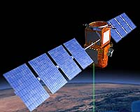
Paris - Apr 21, 2004 NASA's CALIPSO (Cloud-Aerosol Lidar and Infrared Pathfinder Satellite Observations) instruments completed a successful series of ground tests at Ball Aerospace & Technologies Corp., Boulder, Colo. These instruments will improve worldwide climate predictions and provide a better understanding of how airborne particles and clouds affect our atmosphere. CALIPSO was then shipped to the Alcatel Space facility in Cannes, France, where the U.S. and French payload will be integrated into a Proteus spacecraft platform. CALIPSO is expected to give the international science community a better understanding of clouds and atmospheric aerosols that influence Earth's climate. Data from CALIPSO will help create climate predictions for national and international leaders to make policy decisions about global climate change. CALIPSO is a collaborative effort with the French space agency Centre National d'Etudes Spatiales (CNES), Ball Aerospace, Hampton University and France's Institut Pierre Simon Laplace. Ball Aerospace is responsible for CALIPSO's scientific instrument and communications suite, including the lidar and wide field camera. CNES provided a three-channel imaging infrared radiometer, will monitor and command CALIPSO on its 36-month mission. Final testing and launch of CALIPSO is at Vandenberg Air Force Base, Calf. CALIPSO will share the Delta II rocket in a dual configuration with NASA's CloudSat, a satellite that will use millimeter wave radar to measure cloud properties from space. Launch is planned for early 2005. CALIPSO and CloudSat will fly in orbital formation as part of a constellation of Earth-observing satellites including Aqua, PARASOL, and Aura, collectively known as the "A-train." Community Email This Article Comment On This Article Related Links SpaceDaily Search SpaceDaily Subscribe To SpaceDaily Express Earth Observation News - Suppiliers, Technology and Application
 New York NY (SPX) Jan 11, 2006
The importance of remotely sensed data and technologies to support natural disasters has prompted attention and action in Washington. New initiatives and legislation authorizing appropriations to the remote sensing industry will be discussed at Strategic Research Institute's U.S. Commercial Remote Sensing Industry conference, scheduled for February 9-10, 2006 in Washington D.C. |
|
| The content herein, unless otherwise known to be public domain, are Copyright 1995-2006 - SpaceDaily.AFP and UPI Wire Stories are copyright Agence France-Presse and United Press International. ESA PortalReports are copyright European Space Agency. All NASA sourced material is public domain. Additionalcopyrights may apply in whole or part to other bona fide parties. Advertising does not imply endorsement,agreement or approval of any opinions, statements or information provided by SpaceDaily on any Web page published or hosted by SpaceDaily. Privacy Statement |