|
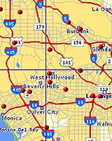
Santa Barbara CA (SPX) Feb 21, 2005 Maps.com has launched NavPro, the industry's first unlimited mapping service that can also generate optimized driving routes for up to 18 stops. This new service not only enables significant time savings in both the planning and the traveling stages of any road trip, but also offers sophisticated features suited for the typical business traveler, including real-time traffic alerts, automatic route optimization, and local destination and attractions mapping. "Although the online mapping industry has been serving consumers for years, it has been severely limited in scope, enabling only basic Point A to Point B routing," said John Serpa, President and CEO of Maps.com. "We listened to our customers' feedback when creating NavPro, the first-ever business reconnaissance tool to help the business traveler be exactly where they need to be, when they need to be there." Designed for business professionals, such as sales and marketing executives who need to make multiple visits in one trip, NavPro's comprehensive feature set and easy-to-use navigational toolbars are ideally suited to a broad range of industries. According to user Giles Kenyon, the Director of Sales at the world's oldest and largest supplier of British car restoration parts, Moss Motors, "My position requires me to make back-to-back business trips around the country. It has always been painstaking to plan these trips, and I've been looking for an easy yet effective way to streamline the process. With NavPro, my sales route and pre-planning time has been significantly shortened, and I'm thrilled knowing that I'm at an advantage, traveling as efficiently as possible." NavPro consists of four primary navigational functions: Mapping, Routing, Traffic and Geo Tools. Each component has zooming capabilities that enable the user to drill down to a street view or zoom out to a city or state-wide view. In addition, all aspects of NavPro are conveniently advertising free, enabling users to plan trips and schedule itineraries without unnecessary distractions. NavPro's unique features and capabilities include: - Multiple address mapping: Allows users to plot destinations in any city in the United States or Canada, and for the first time, generate maps from an unlimited number of addresses. Integration with Microsoft Excel allows for easy data gathering and entry. - Optimized routing: Plots multiple-stop travel itineraries with up to 18 destinations, and uses patent-pending technology to automatically optimize routes. When compared to a standard multi-stop route, NavPro's optimized routing saves users up to 20% in travel time. - Integrated local attractions: Offers pre-travel planning by providing location of popular attractions, such as restaurants, hotels, gas stations, ATMs and airports. - Real-time traffic information: Continuously monitors traffic, accident roadblocks, and construction activity in 69 major metropolitan areas in the U.S. and incorporates this data into travelers' optimized routes. When users scroll over the traffic icons, information appears pertaining to the nature of the incident. If the route is congested, users can get a "Smart Route" bypassing known congestion. - Reliable traffic alerts: Sends traffic reports via email when preferred routes are affected. Up to 8 routes can be monitored at a time. The final component to NavPro's offering, GeoTools, applies the unlimited address mapping function to longitude and latitude coordinates, generating maps based on locations tracked by GPS devices. GeoTools is an ideal mapping service for engineers and urban planners who need to translate coordinates, rather than exact addresses. Community Email This Article Comment On This Article Related Links Maps.com SpaceDaily Search SpaceDaily Subscribe To SpaceDaily Express GPS Applications, Technology and Suppliers
 Cheltenham, England (SPX) Jan 09, 2006
Marotta UK is pleased to announce that it designed, developed and qualified equipment for the cold gas propulsion systems on board the Galileo GIOVE-A, part of Europe's Galileo navigation program, successfully launched by Surrey Satellite Technology (SSTL). |
|
| The content herein, unless otherwise known to be public domain, are Copyright 1995-2006 - SpaceDaily.AFP and UPI Wire Stories are copyright Agence France-Presse and United Press International. ESA PortalReports are copyright European Space Agency. All NASA sourced material is public domain. Additionalcopyrights may apply in whole or part to other bona fide parties. Advertising does not imply endorsement,agreement or approval of any opinions, statements or information provided by SpaceDaily on any Web page published or hosted by SpaceDaily. Privacy Statement |