|
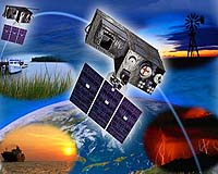
Palo Alto CA (SPX) Oct 12, 2005 The Lockheed Martin Advanced Technology Center has submitted to the NASA Goddard Space Flight Center a formulation phase study proposal for the Geostationary Lightning Mapper instrument that will fly on the GOES-R Series environmental satellites. GLM's ability to monitor convection on a global scale via lightning will provide new insight into the formation, distribution, morphology and evolution of storms, and allows investigation into the mechanisms at the core of the global water and energy cycle. "Along with our teammates from the University of Alabama in Huntsville (UAH), we are confident we have responded with a robust proposal for the Geostationary Lightning Mapper" said Earl Aamodt, Lockheed Martin GLM program manager at the ATC. "Our team has worked together since 1992 on successful lightning imaging missions, and this extensive spaceflight heritage is directly applicable to GLM. The combination of this team�s experience and knowledge of GLM requirements, a proven systems engineering approach, and a detailed formulation phase plan will make GLM formulation phase a success." The observation of lightning by GLM will provide a ubiquitous means of penetrating cloud tops and detecting convective activity continuously over whole continents and adjacent oceans. This lightning characteristic of clouds is inadequately measured, both temporally and spatially, by current observing systems. With improved insight into the dynamics and life cycles of storms and weather systems, GLM will also greatly improve understanding of the fast time scale elements of atmospheric convection. This will lead to a better understanding of the Earth as a system, which combined with long term GLM observations, will lead to significant improvements in monitoring changes in storm climatology. In addition, since intense and increasing in-cloud flashes are known to precede severe weather by tens of minutes, the real-time transmission and distribution of GLM data would greatly improve the lead-time for severe storm warnings, particularly tornadoes. The Geostationary Operational Environmental Satellite (GOES) mission is a critical part of the U.S. satellite constellation for environmental observations, along with the Polar Operational Environmental Satellite (POES) and Defense Meteorological Satellite Program (DMSP) polar orbiting satellites � both built by Lockheed Martin. GOES is the environmental satellite most familiar to the American public, as its images and time-lapse sequences are the primary visual material of television weather forecasts. The GOES system � operational since 1975 � plays a critical role in weather and environmental forecasting. In orbit high above the equator, GOES satellites are uniquely positioned to observe the development of hazardous weather, such as hurricanes and severe thunderstorms, and to track their movement and intensity so that major losses of life and property can be reduced or avoided. The ATC is the research and development organization of Lockheed Martin Space Systems Company (LMSSC). LMSSC, a major operating unit of Lockheed Martin Corporation, designs, develops, tests, manufactures and operates a variety of advanced technology systems for military, civil and commercial customers. Chief products include a full-range of space launch systems, including heavy-lift capability, ground systems, remote sensing and communications satellites for commercial and government customers, advanced Community Email This Article Comment On This Article Related Links SpaceDaily Search SpaceDaily Subscribe To SpaceDaily Express Weather News at TerraDaily.com
 London UK (SPX) Dec 23, 2005
This week's launch of MSG-2 will ensure that satellite images continue to be available to European weather forecasters well into the next decade. It also marks a new chapter in a long-term space experiment measuring the available energy that drives the weather as a whole, and helping to establish how much the Earth is heating up. |
|
| The content herein, unless otherwise known to be public domain, are Copyright 1995-2006 - SpaceDaily.AFP and UPI Wire Stories are copyright Agence France-Presse and United Press International. ESA PortalReports are copyright European Space Agency. All NASA sourced material is public domain. Additionalcopyrights may apply in whole or part to other bona fide parties. Advertising does not imply endorsement,agreement or approval of any opinions, statements or information provided by SpaceDaily on any Web page published or hosted by SpaceDaily. Privacy Statement |