 |
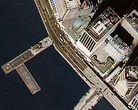
Denver - Oct 16, 2001 Land Info International, LLC, a provider of digital geospatial information across the world, announced the new availability of 0.95-meter, 1.56-meter, and 2-meter imagery from Russian satellites. The data includes recent satellite photos for hundreds of major cities in the United States, Germany, Mexico, Italy, Brazil, Pakistan, Egypt, Turkey and other regions. "Our U.S. and international clients are demanding satellite imagery worldwide, especially for the Middle East, South America, and the United States," commented Michael Blakeman, CEO and president of Land Info International. "The Russian satellite data, combined with our other digital map products, enable Land Info to continue delivering quality data as it has been for the past 10 years." The expanded coverage includes archived panchromatic data from 1992 to 2001. The data is captured through Russia's DK-1, DK-2, and KVR-1000 satellites. Data coverage includes hundreds of major international cities, including Boston, USA; Dallas, USA; Washington D.C., USA; Islamabad, Pakistan; Buenos Aires, Argentina; Cairo, Egypt; Rio de Janeiro, Brazil; Vienna, Austria; and Berlin, Germany. Land Info offers this data as low as $22 per square kilometer. Land Info International provides digital geospatial information of the world, including satellite imagery, 3D models, and topographic maps. Land Info provides clients with the world's largest database of digital topographic and geospatial services and products. Community Email This Article Comment On This Article Related Links Land Info Data Sets Index Land Info International Main SpaceDaily Search SpaceDaily Subscribe To SpaceDaily Express Earth Observation News - Suppiliers, Technology and Application
 New York NY (SPX) Jan 11, 2006
The importance of remotely sensed data and technologies to support natural disasters has prompted attention and action in Washington. New initiatives and legislation authorizing appropriations to the remote sensing industry will be discussed at Strategic Research Institute's U.S. Commercial Remote Sensing Industry conference, scheduled for February 9-10, 2006 in Washington D.C. |
|
|
|
|
|
|
|
|
|
|
|
|
|
| The content herein, unless otherwise known to be public domain, are Copyright 1995-2006 - SpaceDaily.AFP and UPI Wire Stories are copyright Agence France-Presse and United Press International. ESA PortalReports are copyright European Space Agency. All NASA sourced material is public domain. Additionalcopyrights may apply in whole or part to other bona fide parties. Advertising does not imply endorsement,agreement or approval of any opinions, statements or information provided by SpaceDaily on any Web page published or hosted by SpaceDaily. Privacy Statement |
