|
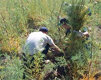
Longmont CO (SPX) Jan 14, 2005 DigitalGlobe announced that Kearny County, Kan. retained the Native Communities Development Corp. (NCDC) to use DigitalGlobe's QuickBird satellite image products for mapping Tamarisk, an invasive plant species that has infested the banks of the Arkansas River. The effective management of Tamarisk has critical implications for human water supply, wildfire prevention and environmental preservation. Tamarisk, also known as Salt Cedar, is a non-native shrub that has invaded stream banks and waterways throughout the southwestern United States. Consuming about twice the amount of water as native plants, large Tamarisk shrubs dry-up water sources by lowering water tables. Current shrubs along parts of the Arkansas River consume enough water to supply 20 million people, or the irrigation of over 1 million acres of land. Tamarisk also presents a significant fire hazard since it monopolizes water resources and deposits thick layers of dry brush and leaves that create a strong fuel source. In addition, the dense Tamarisk branches impede wildlife access to water sources. Not commonly eaten by native wildlife, the plant also alters soil salinity and lowers water quality for water creatures. "One of the greatest limiting factors in understanding and controlling Tamarisk is the lack of detailed, high-resolution maps of the plant's distribution and abundance," said Shannon McCormick, Kearny County Commissioner. "We needed a quick, cost-effective and repeatable method of surveying the area." Kearny County turned to Colorado Springs, Colo.-based NCDC, a DigitalGlobe business partner that specializes in the use of high-resolution satellite imagery for invasive plant delineation, wildfire risk assessment, forest composition analysis and emergency planning. Using QuickBird satellite imagery and Feature Analyst Software from Visual Learning Systems (Missoula, Mont.), in addition to proprietary algorithms, NCDC created a detailed inventory used for developing treatment and control plans. NCDC also created visual, image-based maps to assist in communicating with government agencies and private landowners. QuickBird imagery collected in Sept. 2004 was used by NCDC to assess 32 miles of the Arkansas River. The 874 acres of mature Tamarisk in that area consume about 682 million gallons of water per year, equaling a loss of about $495,000 worth of corn. An estimated $655,000 would be needed to control and restore the Tamarisk growth areas. According to Jason San Souci, director of Remote Sensing Applications at NCDC, "The growth and spread of Tamarisk could not only be controlled, but prevented, if the extent of the infestations were precisely known. For this reason, Kearny County's management strategy must include regular mapping and monitoring with high-resolution satellite imagery." NCDC has developed a set of algorithms to classify and enhance the 60-centimeter resolution QuickBird imagery, which shows details on the ground as small as two feet across. NCDC also provided Kearny County with Earth Map Solutions' AgroWatch Canopy Density Map, ESRI Shapefiles of salt cedar infestations and cottonwood trees, and a QuickBird imagery-based 3-D virtual "fly-through" of the Arkansas River project area. Community Email This Article Comment On This Article Related Links DigitalGlobe NCDC SpaceDaily Search SpaceDaily Subscribe To SpaceDaily Express Earth Observation News - Suppiliers, Technology and Application
 New York NY (SPX) Jan 11, 2006
The importance of remotely sensed data and technologies to support natural disasters has prompted attention and action in Washington. New initiatives and legislation authorizing appropriations to the remote sensing industry will be discussed at Strategic Research Institute's U.S. Commercial Remote Sensing Industry conference, scheduled for February 9-10, 2006 in Washington D.C. |
|
| The content herein, unless otherwise known to be public domain, are Copyright 1995-2006 - SpaceDaily.AFP and UPI Wire Stories are copyright Agence France-Presse and United Press International. ESA PortalReports are copyright European Space Agency. All NASA sourced material is public domain. Additionalcopyrights may apply in whole or part to other bona fide parties. Advertising does not imply endorsement,agreement or approval of any opinions, statements or information provided by SpaceDaily on any Web page published or hosted by SpaceDaily. Privacy Statement |