|
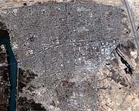
Wollongong, Australia (SPX) Dec 07, 2004 High-resolution satellite imaging has enhanced the media's coverage of war zones and disaster areas, but the full potential of this new technology has not been realised by the media. A study by two academics at the University of Wollongong, Australia, has found that satellite imagery is still not fully understood by most media organisations. Morris Jones and Eric Loo, both from the University's School of Journalism and Creative Writing, found that satellite imagery is becoming more widespread as a media tool, but its usage is dominated by large media organisations, principally in the USA. Satellite images appearing outside of large media conglomerates are generally channelled through news feed organisations such as Associated Press and Reuters. "Satellite imagery offers a unique aerial perspective that's sometimes more revealing than a photograph taken from a ground location", explained Jones. Understanding the layout of buildings in a city or the scope of a natural disaster such as flooding were examples. In some cases, particularly with war zones, satellite imagery could provide coverage of areas where it was unsafe to send journalists. Satellite images were also used extensively to cover regions that were off-limits to most local residents. In 2001, a US surveillance aircraft made an emergency landing at a Chinese air base on Hainan Island, following a mid-air collision with a Chinese jet fighter. Satellite imagery revealed the US plane parked on the tarmac of the restricted air base, which marked the first extensive use of satellite imagery for a breaking news story. Suspected nuclear weapons facilities in Iran and North Korea attracted considerable media attention in 2003 and 2004. Most of the visuals displaye!d in the media were taken by satellite. Prior to the 2003 US-led invasion of Iraq, major news organisations stockpiled satellite images of major cities and military installations in Iraq. The images were used to generate amazing "fly through" perspectives on locations under attack, which supplemented the reports of embedded reporters on the ground. But the stockpiling was also motivated by fears that the media would lose access to other sources of coverage if censorship were introduced. In practice, restrictions on the use of satellites for media coverage seem to be less of a problem than some pundits expected. "Shutter control" laws, introduced at the debut of the commercial high-resolution remote sensing industry, have never been formally invoked. A form of "chequebook shutter control" was introduced during the 2001 invasion of Afghanistan, when the US Government bought exclusive rights to images from the Ikonos satellite for the earliest stages of the military campaign. But no formal or corporate forms of censorship appeared during the 2003 Iraq campaign. Commercial satellite operators are mostly dependent on the US Government for their revenue, and view the media as an extremely minor source of income. "They profess to have no money", explained Mark Brender, Vice President for Corporate Communications at Space Imaging, a commercial satellite operator. But satellite firms are generally willing to supply imagery to the media for free. The frequent use of satellite images in the mass media is seen as a useful way of generating brand awareness for their products, which generates paying clientele. Images are regularly pumped into media organisations through mailing lists operated by satellite companies, who anticipate requests for images of newsworthy locations. The process, similar to distributing media releases, was dubbed the "satellite spoonfeed" by Jones and Loo. "Without free and easy access to the imagery, much of it would simply never appear in the media", Jones observed. Despite their usefulness, problems have already appeared in the management and interpretation of satellite imagery in the media. Soon after New York and much of the USA experienced power blackouts in 2003, an image professing to be a satellite view of the blackout appeared on the Internet. The image showed most of the continent lit up, but a large segment of the north east was completely dark. This image was published by some media sources, but was soon exposed as a fake. In 2004, a train exploded in North Korea near the Chinese border. Satellite imagery was quickly used to show the devastation in this inaccessible region, as North Korea restricted access to the site by journalists. Some media sources soon published an additional satellite image, showing an explosion taking place. However, the explosion in the image had actually occurred in Iraq some months earlier. Interpreting satellite imagery is a skill in its own right, and intelligence organisations employ trained professionals specifically for the task. Jones and Loo found that the media was failing to access or develop photographic interpreters to deal with satellite imagery in journalism. John Pike, Director of the Washington-based strategic watchdog Globalsecurity.org, explained that the media was generally unwilling to pay for external consultants. Pike, and other strategic analysts, had enjoyed brief periods as paid talent for major news organisations during the 2003 Iraq war, but found that their contracts were not renewed as the military campaign passed its major phase of combat operations. Despite these problems, Jones and Loo expect the use of satellite imagery in the media to become more widespread in the future, as awareness of the technology increases. Community Email This Article Comment On This Article Related Links University of Wollongong SpaceDaily Search SpaceDaily Subscribe To SpaceDaily Express Earth Observation News - Suppiliers, Technology and Application
 New York NY (SPX) Jan 11, 2006
The importance of remotely sensed data and technologies to support natural disasters has prompted attention and action in Washington. New initiatives and legislation authorizing appropriations to the remote sensing industry will be discussed at Strategic Research Institute's U.S. Commercial Remote Sensing Industry conference, scheduled for February 9-10, 2006 in Washington D.C. |
|
| The content herein, unless otherwise known to be public domain, are Copyright 1995-2006 - SpaceDaily.AFP and UPI Wire Stories are copyright Agence France-Presse and United Press International. ESA PortalReports are copyright European Space Agency. All NASA sourced material is public domain. Additionalcopyrights may apply in whole or part to other bona fide parties. Advertising does not imply endorsement,agreement or approval of any opinions, statements or information provided by SpaceDaily on any Web page published or hosted by SpaceDaily. Privacy Statement |