|
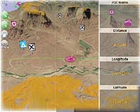
Denver CO (SPX) Feb 05, 2008 Magellan announced the market availability of AccuTerra outdoor map content from Intermap Technologies. Beginning in April, Magellan customers can download the most comprehensive recreational content " including clear markings for public and private property -- for the new line of Magellan Triton GPS devices as well as its eXplorist line of handheld GPS devices. Triton and eXplorist customers can acquire digital terrain data, off-road and recreation-related roads, trails, and points-of-interest for most recreation areas in the United States. AccuTerra provides map content for the lower 48 states plus Hawaii and will be available for purchase directly from the Magellan web site. "We are pleased that Magellan has chosen to complement its Triton product line with the nation's best recreational map content for GPS devices," commented Eric DesRoche, senior vice president of consumer electronics for Intermap Technologies. "AccuTerra is also compatible with Magellan's eXplorist products that support map data. These accurate and detailed maps will greatly enhance the user experience for hundreds of thousands of Magellan handheld customers." Intermap is creating consumer mapping products using Magellan's Solution Developer Kit (MSDKTM) MapCreator software. MSDK is a 3rd party development toolkit that enables licensees to develop world class mapping products and software enhancement to enhance Magellan's GPS product line offerings. MSDK-derived content products are compatible with both GPS devices and VantagePointTM desktop software. AccuTerra data includes elevation information, clearly identified and classified trails, paths and roads, outdoor-specific points of interest such as campgrounds, service facilities, and landmarks; and a land-use display that depicts the location of public and private property. "Intermap's new recreational data sets are an excellent addition to our leading line of GPS solutions, providing us with a tremendous opportunity to offer our customers a differentiated and superior line of products," said Christian Bubenheim, vice president of product marketing for Magellan. "Our customers can now transform their recreational experience with the most feature-rich map data available on the market today " all in one powerful device." AccuTerra data for the United States will be available in April, 2008 via download. Magellan devices supporting the AccuTerra products are the Triton 400, 500, 1500, 2000 units, and the eXplorist 400, 500, 600, and XL units. Community Email This Article Comment On This Article Related Links Intermap Technologies GPS Applications, Technology and Suppliers
 Orlando FL (SPX) Feb 05, 2008
WeatherBug, operator of the world's largest proprietary weather network, and the Club Managers Association of America (CMAA), announced today WeatherBug Club Safety, a comprehensive suite of solutions to help club managers and supervisors respond to and handle weather-related risks, enhance member safety and experience, and improve operations. |
|
| The content herein, unless otherwise known to be public domain, are Copyright 1995-2007 - SpaceDaily.AFP and UPI Wire Stories are copyright Agence France-Presse and United Press International. ESA Portal Reports are copyright European Space Agency. All NASA sourced material is public domain. Additional copyrights may apply in whole or part to other bona fide parties. Advertising does not imply endorsement,agreement or approval of any opinions, statements or information provided by SpaceDaily on any Web page published or hosted by SpaceDaily. Privacy Statement |