|
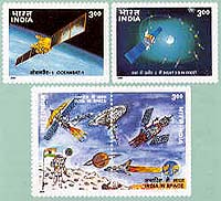
Delhi, India (SPX) Jan 04, 2006 The Indian Remote Sensing satellite, IRS-1C, which was launched on December 28, 1995, has completed ten years of operation. IRS-1C carried a unique combination of three state-of-the-art cameras - a Panchromatic Camera with a spatial resolution of 5.8 metre, a Linear Imaging Self Scanner-3 with a resolution of 23 metre and a Wide Field Sensor with a resolution of 188 metre. When it was launched, IRS-1C was the most advanced civilian remote sensing satellite. This satellite was launched into a polar sun-synchronous orbit of 817 km by the Russian Molniya Launch Vehicle. Even though designed life of IRS-1C was three years, the meticulous in-orbit operations of the satellite by the ISRO Telemetry, Tracking and Command Network (ISTRAC) coupled with the highly efficient use of the on-board propellant for its orbit and orientation control as well as the high reliability built into its subsystems have enabled IRS-1C to far outlive its designed life. The success of IRS-1C paved the way for India to enter into the global remote sensing market and to capture a substantial share for remote sensing data market. More than US $ 10 million in revenue by data sale from IRS-1C has accrued so far. IRS-1C data provided a great fillip to remote sensing applications in India like crop acreage and yield estimation, forest resources survey, urban mapping, flood mapping, wasteland mapping and drought monitoring and assessment. IRS-1C was followed by an identical satellite IRS-1D, which was launched by India's own Polar Satellite Launch Vehicle, PSLV, on September 29, 1997. This, in turn, paved the way for the launch of more theme-oriented remote sensing satellites like OCEANSAT-1, RESOURCESAT-1 and CARTOSAT-1. In the past one decade, IRS-1C has orbited the earth nearly sixty thousand times and sent lakhs of imageries. Community Email This Article Comment On This Article Related Links SpaceDaily Search SpaceDaily Subscribe To SpaceDaily Express Earth Observation News - Suppiliers, Technology and Application
 New York NY (SPX) Jan 11, 2006
The importance of remotely sensed data and technologies to support natural disasters has prompted attention and action in Washington. New initiatives and legislation authorizing appropriations to the remote sensing industry will be discussed at Strategic Research Institute's U.S. Commercial Remote Sensing Industry conference, scheduled for February 9-10, 2006 in Washington D.C. |
|
| The content herein, unless otherwise known to be public domain, are Copyright 1995-2006 - SpaceDaily.AFP and UPI Wire Stories are copyright Agence France-Presse and United Press International. ESA PortalReports are copyright European Space Agency. All NASA sourced material is public domain. Additionalcopyrights may apply in whole or part to other bona fide parties. Advertising does not imply endorsement,agreement or approval of any opinions, statements or information provided by SpaceDaily on any Web page published or hosted by SpaceDaily. Privacy Statement |