|
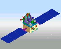
New Delhi, India (SPX) Jan 17, 2005 India will put into space two satellites- one for mapping and other with multiple uses- by May-June, the chief of the country's space agency said in Bangalore Friday, according to Indo-Asian News Service. The Indian Space Research Organization (ISRO) will launch the Cartosat-1, equipped with cameras with a resolution of 2.5 meters to undertake mapping applications, in March-April, and the Insat-4A satellite in May-June. ISRO chairman G. Madhavan Nair said that Cartosat-1 will be launched from the Satish Dhawan Space Center at Sriharikota in Andhra Pradesh using the indigenous polar satellite launch vehicle(PSLV). "We are targeting the launch of Cartosat-1 for March-April and that of Insat-4A for May-June from Korou in French Guyana on board the European Space Agency's geo-synchronous launch vehicle," Nair said on the sidelines of a function. The ISRO made extensive use of its remote sensing and Insat series of satellites for surveying and mapping the extent of damage caused by the tsunami along India's southern coast, Andaman and Nicobar Islands, Sri Lanka and even Indonesia. "We have given the satellite data to government authorities, including district officials, indicating the extent of damage for undertaking rescue and relief operations," Nair said. Community Email This Article Comment On This Article Related Links ISRO Cartosat-1: Technical features and data products SpaceDaily Search SpaceDaily Subscribe To SpaceDaily Express Earth Observation News - Suppiliers, Technology and Application
 New York NY (SPX) Jan 11, 2006
The importance of remotely sensed data and technologies to support natural disasters has prompted attention and action in Washington. New initiatives and legislation authorizing appropriations to the remote sensing industry will be discussed at Strategic Research Institute's U.S. Commercial Remote Sensing Industry conference, scheduled for February 9-10, 2006 in Washington D.C. |
|
| The content herein, unless otherwise known to be public domain, are Copyright 1995-2006 - SpaceDaily.AFP and UPI Wire Stories are copyright Agence France-Presse and United Press International. ESA PortalReports are copyright European Space Agency. All NASA sourced material is public domain. Additionalcopyrights may apply in whole or part to other bona fide parties. Advertising does not imply endorsement,agreement or approval of any opinions, statements or information provided by SpaceDaily on any Web page published or hosted by SpaceDaily. Privacy Statement |