|
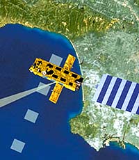
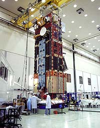
Rome (ESA) Jan 28, 2002 In a cool, air conditioned room on the ground floor of a modern building on the outskirts of Rome, a young scientist is carefully handling a "pizza". But this "pizza" is certainly not for eating. It's the term coined by researchers at ESRIN, the European Space Agency's centre in Italy for the large rectangular cassettes on which information from space is soon to be stored. Containing 1.7 km of tape, these "pizzas" will hold the huge amounts of data that will shortly stream down from Envisat, the environmental monitoring satellite from the European Space Agency, slated for launch at the end of February 2002. Perhaps the most complicated satellite the Agency has ever launched, Envisat will look down on the Earth with an unparalleled array of complex instruments. But it's not just the complexity of the instruments that's exciting scientists all over Europe. Many say it's more the quantity and quality of the data that will flow from Envisat that's the real cause of scientific interest. For scientists involved in climate research, the belief is that the data in the "pizzas" will resolve some of the outstanding issues in global climate change. If this happens, say the scientists; they have no doubt that Envisat will also directly impact the actions of politicians at both national and European level. Mark Doherty, head of the exploitation division at ESA/ESRIN is highly confident about the impact of Envisat. "Robust reliable global environmental information is going to be an economic, political and eventually a security must within the next 5 to 15 years. It's going to be red hot. And Europe must have the capability to get this information." He believes that Envisat can deliver this valuable resource not just for scientists and politicians but for citizens as well. So what convinces hard headed scientists like Mark Doherty that a lone satellite can so change the world we live in? It's the simple faith that good science can lead to political decisiveness and informed public opinion. And this belief is based on the bedrock of good data. Most scientists, whatever their field, will concede that although they seek truth, they do not know it or even generate it. The only thing that science really has is observable evidence. As Francis Bacon said almost 400 hundred years ago: "For man is but the servant or interpreter of nature, what he does and what he knows is only what he has observed of nature's order, in fact or in thought". But while evidence or data gives science the strength of its conclusions, the nature of data can also weaken science and cast doubt on its ability to characterise reality. Nowhere is this more evident than in relation to climate change. Let's look at some of the outstanding areas of contention. Despite general scientific agreement on the role of carbon dioxide in causing global warming we are still uncertain about how much there is and how much is absorbed by the seas and forests. Prof. Hartmut Grassl is a former director of the World Climate Research programme (WCRP). He says that our lack of scientific understanding about the release and retention of carbon dioxide feeds into a much broader political argument. According to Prof. Grassl, Envisat will provide an independent and unbiased resolution to this problem. "There is a sensor on Envisat which will give us the CO2 content of the atmosphere -- it's an instrument called SCIAMACHY. This will be a major breakthrough of our understanding of the carbon cycle. With this data we could derive the sources and sinks of carbon. "If you have the full content of carbon in the atmosphere for a certain place and you measure it every few days, you can run a model and ask it how strong was the net source or sink of carbon over Germany or Britain or the Atlantic. By combining your model with information from Envisat, you would be able to say if the German forest is really a sink of carbon in the summer -- this is a good example of the use of science data for a political decision." This could have a major impact on current political negotiations. Arguments over the levels of carbon sequestration are dominating the negotiations between the parties implementing the Kyoto Protocol. According to Jos Delbeke, one of the leading negotiators for the European Union and director of the European Commission's climate change department, the promise of the Envisat data could really help the politicians. "Satellite data in general are pretty weak except for carbon dioxide emissions. Non CO2 gases and carbon sequestration are the areas in which we have major uncertainties and indeed even methodological problems. But if we can get a regional and global picture on sequestration from the SCIAMACHY instrument that would be a major advantage. There are lots of questions on which we have not got good information and not even a good methodological basis, and this Envisat methodology could be useful for that." As well as breaking new ground with instruments that are state of the art, Envisat will also impact because these instruments will work together in unprecedented ways. And for scientists the ability to have different data from different instruments, all working together is very exciting. According to Dr. Bryan Lawrence, head of the British Atmospheric Data Centre at the Rutherford Appleton Laboratories, this will be a key advantage of the data from Envisat. As an example, he points to the ongoing problems with Ozone. Despite successes in recent years in removing chloroflourocarbons or CFCs from the environment, Dr. Lawrence says there are still huge gaps in our understanding of the Ozone layer. "People keep saying that Ozone is a solved problem, we have these international agreements and it's all over now, we just have to wait for this stuff to get out of the atmosphere. It's just not that simple. We don't know about the chemicals that have replaced CFCs. Are they really that safe? Everyone thought that CFCs were safe, for 60 - 80 years they were the safest things going, you could drink the things, and they were that safe! Except nobody knew about his or her impact on Ozone. With some of the replacements we already know we don't understand the chemistry as well as we should. Envisat will give us instruments that will measure the chemistry with unprecedented resolution and it's the synergy of having those measurements that will be significant. Again it's the synergy of the data that will make it special." These are just some of the controversial scientific questions that Envisat will attempt to answer. But what makes Envisat's answers different from any one of a dozen other space based platforms? It's the data. The quantity, quality, and evaluation of which break new ground for an earth observing satellite. Envisat has ten instruments that will churn out a huge range of data. Every day enough data to fill the hard disks of hundreds of PCs will be beamed down to earth, collected via listening stations and assembled at ESA/ESRIN in Rome. According to Olivier Arino, who heads the project section developing application products for institutional users at ESRIN, Envisat is unique in data terms. "It is the only one that will be providing, operationally in near real time, the bunch of data required by institutions to monitor the Kyoto protocol implementation and other environmental treaties". But size isn't everything. According to Mark Doherty, sometimes small amounts of data can give you vital information. "The altimeter on Envisat for instance can measure changes in sea surface level in centimetres, so if you want to monitor where sea levels are rising, this is essential. "This instrument produces small amounts of data but the value of the information far outweighs the amount of data. The data amounts are interesting but its much more interesting to know the insights and the global vision that you get from them." Data in whatever quantities can be very useful for scientists but only if it is reliable. There have been controversies in the past where information from satellites has not matched up to observations taken from the Earth. So how will ESA ensure that Envisat's data is trustworthy? "As a matter of credibility we are co-ordinating with a world wide organisation, the Committee on Earth Observation Satellites", says Yves-Louis Desnos, who manages the scientific projects of Envisat at ESA/ESRIN. "We ensure current data sets between the different earth observation missions, from NASA and ESA and others. We have financed a ship campaign in Miami, where we put on the same ship all the instruments used to calibrate and validate the measurements of the ocean temperature. With this information we can ensure that the measurements made by Envisat or by American satellites have the same traceability and are calibrated with each other. This allows us to be able to monitor ocean temperature variation over ten years with an accuracy of 0.3 degrees. Then we can monitor trends in the global climate with confidence."
|