|
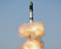
Baikonur, Kazakhstan (SPX) Jun 15, 2007 The successful launch of the German radar satellite TerraSAR-X on Friday 15 June 2007 at 08:14 local time (04:14 CEST) from the Russian Cosmodrome in Baikonur (Kazakhstan) represents the start of a new level of quality in the mapping of Earth. Over the next five years, new and high-quality radar images of our planet's surface will be collected. "The aim of the five-year mission is to use radar to collect new, high-quality data of Earth's surface," says Prof. Johann-Dietrich Worner, Chairman of the German Aerospace Center (DLR). He continues: "TerraSAR-X is the first German satellite developed within the framework of a public-private partnership (PPP) between government and industry." The total costs for the building and launch of the satellite amount to 130 million euros. From this, DLR is responsible for 102 million euros and the space company Astrium for 28 million euros. The development of the ground segment and the ongoing costs for the five year mission cost an extra 55 million euro for which DLR is responsible for 45 million euros. The remainder of this cost is taken up by Infoterra GmbH, a subsidiary of Astrium founded specifically for the commercial marketing of the data. The use of the data for scientific purposes will be the task of DLR, which is also responsible for the mission concept and implementation, as well as control of the satellite. Astrium is contributing towards the costs of development, construction and use of the satellite. Infoterra GmbH takes over the commercial marketing of the data. 50% of the available data will benefit the scientific community and the other half is made commercially available to industry . TerraSAR-X has built upon the technical knowledge learned from previous radar missions, and scientists have developed new techniques to be used by the satellite. For instance, Earth's vegetation is of vital importance to human life. Precise and current information about the distribution, composition and change of kinds of vegetation forms the basis for many applications. One of the outstanding characteristics of TerraSAR-X is its high spatial resolution, exceeding conventional radar systems. This makes it possible for scientists to study detailed soil characteristics and be able to observe and better classify different arable crops. TerraSAR-X will also offer completely new perspectives for the observation of urban areas. The high resolution of TerraSAR-X will enable individual buildings, urban structures and infrastructure such as roads and railway lines to be accurately mapped. Another scientific application for TerraSAR-X is the observation of Earth's oceans and coastal regions which are subject to human activities such as offshore drilling, shipping and fishing. Global climate change is affected by the expansion, contraction and distribution of sea ice as well as by the volume of icebergs. In observing the polar regions using radar, the freeing of TerraSAR-X from the vagaries of the weather, and also independence from whether or not the Sun is shining, are great advantages. The satellite will circle Earth at a height of 514 kilometres in a polar orbit, using its active antenna to gather radar data day and night, at a resolution of up to one metre, regardless of weather conditions or cloud coverage. Beside the radar, there are also two secondary payloads on board: The Laser Communication Terminal (LCT) is a technology demonstrator to be used in orbit, for the verification of fast optical data communication in space. With financing from DLR and built by the company TESAT, the instrument is a connection between TerraSAR-X and a future ground station. Over this new laser system, large datasets can be sent to Earth. The Tracking, Occultation and Ranging Experiment (TOR) was built for TerraSAR-X in a cooperation between the GeoForschungsZentrum Potsdam (GFZ) and the Center for Space Research at the University of Texas (UT-CSR). It consists of a dual-frequency GPS (Global Positioning System) as well as a laser reflector unit. TOR allows the satellite to perform highly-accurate course changes as little as 10 centimetres, which improves the quality of the radar images. Email This Article
Related Links  Richland WA (SPX) Jun 15, 2007
It has been an elusive goal for the legion of chemists trying to pull it off: Replace crude oil as the root source for plastic, fuels and scores of other industrial and household chemicals with inexpensive, nonpolluting renewable plant matter. Scientists took a giant step closer to the biorefinery this week, reporting in the June 15 issue of the journal Science that they have directly converted sugars ubiquitous in nature to an alternative source for those products that make oil so valuable, with very little of the residual impurities that have made the quest so daunting. |
|
| The content herein, unless otherwise known to be public domain, are Copyright 1995-2006 - SpaceDaily.AFP and UPI Wire Stories are copyright Agence France-Presse and United Press International. ESA PortalReports are copyright European Space Agency. All NASA sourced material is public domain. Additionalcopyrights may apply in whole or part to other bona fide parties. Advertising does not imply endorsement,agreement or approval of any opinions, statements or information provided by SpaceDaily on any Web page published or hosted by SpaceDaily. Privacy Statement |