|
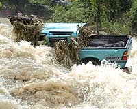
Miami FL (SPX) Aug 18, 2006 When a hurricane strikes, authorities are increasingly turning to satellite images and computer-based maps to tell them everything from where the most vulnerable people live to where the closest supply of food, water and ice is located. While these maps can be beneficial in planning response and recovery, their imprecise nature can result in people not getting the help they need. That's why Florida State University geography Professor Mark W. Horner has received a $64,760 grant from the National Science Foundation to develop new spatial models for disaster relief. "Planning for disaster relief is of great societal importance as we learned during last year's devastating hurricane season," Horner said. "I hope to improve the way geographical phenomena are represented in mathematical models used to allocate disaster relief goods. Better models, in turn, will lead to improvements in our ability to plan and prepare for extreme weather events." By trying out different mathematical equations, Horner hopes to develop new methods that will allow more detailed models to be implemented within geographic information systems (GIS) - computer-based systems that allow users to analyze and visualize geographically referenced data. More detailed information will result in a reduction of errors in assessments of factors such as response and travel time to nearest relief centers. Generally, any spatially referenced data that might be needed to assess or perform disaster relief - information on storm tracks, populations, and road and highway infrastructure - can be stored in a GIS, Horner said. When the computer-based systems are combined with remotely sensed aerial or satellite images, they produce maps that can be powerful decision-making tools. The downside is that these models can be mathematically complex, so geospatial analysts often choose to use less detailed maps and data sets in order to get results in a reasonable amount of time. For example, in many spatial models, all of the interaction and movement in a small city might be represented as occurring between a relatively small number of points - an obvious oversimplification of activity that could result in relief aid not being delivered to places near where people actually live. Horner will examine the tradeoffs that come with these types of decisions to develop more effective models. "The real world is infinitely complex, and the hard drives and memory of computers, while expansive, are not so," Horner said, explaining why choices must be made about how to represent the real world within the confines of a computer. To test his new models, Horner and doctoral student Joni Downs will conduct a series of computational GIS-based experiments that simulate a hurricane striking selected cities in Florida. The simulations will model the distribution of relief goods and services in scenarios that take into account the extent of hurricane damage, the availability of governmental and relief agency resources and the demand for food, water and ice. Horner will compare the performance of his new spatial models to results obtained using existing approaches and will share his findings with state and local agencies. FSU geography Professor James Elsner, an expert on long-range predictability of hurricanes, will serve as a consultant on the project. Community Email This Article Comment On This Article Related Links A world of storm and tempest Bring Order To A World Of Disasters Bringing Order To A World Of Disasters When the Earth Quakes A world of storm and tempest
 Tokyo (AFP) Aug 17, 2006
A typhoon churned toward Japan's Pacific coast Thursday with heavy rain and choppy waves, leaving three people including a middle-aged surfer dead or missing, officials said. |
|
| The content herein, unless otherwise known to be public domain, are Copyright 1995-2006 - SpaceDaily.AFP and UPI Wire Stories are copyright Agence France-Presse and United Press International. ESA PortalReports are copyright European Space Agency. All NASA sourced material is public domain. Additionalcopyrights may apply in whole or part to other bona fide parties. Advertising does not imply endorsement,agreement or approval of any opinions, statements or information provided by SpaceDaily on any Web page published or hosted by SpaceDaily. Privacy Statement |