|
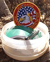
Malmstrom AFB MT (SPX) Mar 15, 2005 The coordinates N 47ďż˝ 12.595 W 110ďż˝ 55.990 mean very little to most people, but to a group of hunters know as "geocachers," it's the beginning of an adventure that starts on a mountainside in Sluice Boxes Primitive State Park and ends with a hidden treasure in the park's belly. "Geocaching" is a sport where people, using a handheld global positioning satellite system, comb countrysides in search of "caches," containers ranging in size from 35 mm film cases to standard military ammo boxes, which usually contain a log book, pen and various small trinkets. Once they find a cache, hunters sign a logbook, exchange a trinket and return the cache to its hiding place. The only requirements for this outdoor hunt are a GPS receiver and a sense of adventure. A base-line receiver can be bought at any sports or electronics store for approximately $100. There are 25 caches within 30 miles of Malmstrom's front gate and more than 750 scattered throughout Montana. The sport began in May of 2000, following an announcement from former president Bill Clinton's administration that the intentional degradation of GPS signal to consumer GPS systems were being removed, making consumer devices 10 times more accurate. The first cache was hidden May 3, 2000, outside of Portland, Ore. Within three days, the cache had been visited twice and a global phenomenon was born. Today, there are 146,137 active caches in 213 countries according to www.Geocaching.com, the official Web site of the sport. The backbone of this sport rests in the hands of Air Force Space Command operators and maintainers, whose mission includes the Navstar Global Positioning System that make it all possible. "The Navstar Global Positioning System is a constellation of orbiting satellites that provides navigation data to military and civilian users all over the world. The system is operated and controlled by the 50th Space Wing, located at Schriever Air Force Base, Colo.," according to the Schriever Web page. The Delta II expendable launch vehicle is used to launch GPS satellites from Cape Canaveral Air Station, Fla., into nearly 11,000-mile circular orbits. "We're the satellite flyers here at the 50th Space Wing," said Ed Parsons, chief of public affairs there. "We fly the GPS satellites and keep them operating so that GPS users, both military and civilian, are able to take full advantage of this state-of-the-art satellite navigation system in their own backyards." The GPS Master Control Station, operated by the 50th Space Wing's 2nd Space Operations Squadron at Schriever, is responsible for monitoring and controlling the GPS satellite constellation. The GPS-dedicated ground system consists of five monitoring stations and four ground antennas located around the world. The monitor stations use GPS receivers to passively track the navigation signals on all satellites. "From being able to direct munitions to an exact target to guiding outdoor enthusiasts along a sophisticated scavenger hunt, there isn't a more exact timing and navigation system anywhere," said Col. Gregg Billman, commander of the 45th Operations Group at Patrick AFB, Fla. "That's the utility and versatility of GPS, and it's only launched from Cape Canaveral Air Force Station." "The sport provides a great way for families to get out and enjoy the beauty of Montana," said Airman 1st Class Chris Callihan, 341st Security Forces Squadron. "A lot of times the caches lead you to parks and playgrounds you've driven past a dozen times but never seen." After purchasing a GPS receiver, the next step is visiting The Official Global GPS Cache Hunt Site, www.Geocaching.com, to get a list of caches. Once a cache is selected, the Web site lists the latitude and longitude coordinates and provides links to maps of the area. These maps are not only helpful for finding the cache, they also provide a general idea of the driving directions. The last step before heading out and crossing another cache off the list is safety. People should be sure to let someone know where they are going and a time they expect to be back in case an accident occurs. With a GPS receiver leading them and a lunch in their packs, "cachers" around the world search long into the day yearning for another shot of adrenaline when they discover their next "geocache." Community Email This Article Comment On This Article Related Links Geocaching.com SpaceDaily Search SpaceDaily Subscribe To SpaceDaily Express GPS Applications, Technology and Suppliers
 Cheltenham, England (SPX) Jan 09, 2006
Marotta UK is pleased to announce that it designed, developed and qualified equipment for the cold gas propulsion systems on board the Galileo GIOVE-A, part of Europe's Galileo navigation program, successfully launched by Surrey Satellite Technology (SSTL). |
|
| The content herein, unless otherwise known to be public domain, are Copyright 1995-2006 - SpaceDaily.AFP and UPI Wire Stories are copyright Agence France-Presse and United Press International. ESA PortalReports are copyright European Space Agency. All NASA sourced material is public domain. Additionalcopyrights may apply in whole or part to other bona fide parties. Advertising does not imply endorsement,agreement or approval of any opinions, statements or information provided by SpaceDaily on any Web page published or hosted by SpaceDaily. Privacy Statement |