|
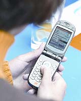
Binyamina, Israel (UPI) Jun 07, 2006 by 2007, cellular customers in the United States and Europe will be able to use their phones to get to the nearest restaurant, find out if it's open and see the daily specials, according to a company that programs global positioning platforms for mobile phones. "The United States will be a big navigation market," the sales director of Herzliya, Israel-based Telmap, Ziv Orr, told United Press International in a telephone interview. He said there are already "tens, hundreds" of handset models there equipped with Assisted GPS, a technology that uses an assistance server to cut down the time needed to determine a location. In Europe, by comparison, "the GPS-embedded process is slower," Orr said, with only five models currently equipped with A-GPS. The bottom line is that in the near future, GPS will go the way of the camera and become a standard feature for phones in the medium price range and higher, Orr said. Telmap already has GPS platform supply deals with three Israeli mobile providers, MIRS, Pelephone and Cellcom, and boasts 70,000 users, according to Orr. The deal with Pelephone, announced two weeks ago, was signed with the United States in mind, Orr said, because like 50 percent of the American market, Pelephone operates on a Code Division Multiple Access system. "We wanted to prepare with a client that uses CDMA," Orr said. The technology allows every cellular channel to use the full spectrum available, unlike GSM's Time Division Multiple Access technology, which assigns each channel a specific frequency. The Pelephone deal also allows the company, whose platform is Java-based, to use BREW and Windows Mobile applications. Israelis with GPS capabilities use their telephone's navigation feature, where voices and maps direct him to a destination, an average of 13 times per month, he added. "I don't know of any (other cell phone) application that is used so much," Orr said. Besides the navigation feature, users can look at maps and execute address and point-of-interest searches, Orr said. Telmap's platform also serves as a channel for customers to download other content features like traffic-report cameras for an extra fee. "Content is king," Orr said. "It's a way to keep customers and attract new customers." Telmap's GPS information and maps are "off-board," meaning the user downloads them as needed and that the company updates them every three months, Orr said. "On-board" devices don't require a download every time the customer uses the system but are time-consuming and costly to update, he added. But the real question about a phone embedded with GPS technology is what happens when someone calls. Do you have to pull over? Will the voice telling you to turn right interrupt your conversation? "When I drive, several things can happen: there could be an incoming call; I could make a mistake; I could encounter a 'black hole' without coverage," Orr explained. He said that other GPS platforms only download the calculated route at the beginning of the trip. If a call comes in, the GPS stops, and it takes time, costs money and is annoying to recalculate the route, he said. "This is unacceptable," Orr said, emphasizing that the technology has to be user-friendly. As a result, Telmap's application downloads a "fish bone" -- the best route along with all the other roads around it, in a 600-meter radius. This way, "I can talk; I can make a mistake ... it's not dependent on the network" and doesn't need to be re-downloaded if something interrupts the chosen route, Orr said. This system, called Mobile Optimized Navigation Data, or MOND, is unique to the company, Orr said. Several U.S. cell-phone carriers already offer Location-Based Services, or LBS: Sprint, Verizon and Disney Mobile have or are developing "family finder" technology that allows parents to locate their kids' cell phones without calling them. Verizon and Sprint also offer more traditional GPS navigation services. Another Israeli company, 3DVU, is using a Google Earth-like model for navigation. The company, which already provides a similar service to some Japanese cars, presented its cellular technology at February's 3GSM World Congress in Barcelona, Spain. Reviews of the 3DVU's car navigation systems have been mixed. While Michael Rogers wrote in Newsweek in 2003 that 3DVU's technology was an exciting "hint of the future," Rafe Needleman wrote in Red Herring in 2001 that he'd rather have "the richness of a good (traditional) map, the exclusion of datanoise, and the art of fitting that information into a single image." "On the other hand," he wrote, echoing proponents of GPS, "when I'm lost, I just want directions."
Source: United Press International Community Email This Article Comment On This Article Related Links - GPS Applications, Technology and Suppliers
 Gaithersburg MD (SPX) Jun 05, 2006
Lockheed Martin and EADS Astrium announced Sunday they have signed a teaming agreement to ensure interoperability of the Global Positioning System III and the European Galileo Satellite Navigation programs - the world's two most important upcoming satellite navigation systems. |
|
| The content herein, unless otherwise known to be public domain, are Copyright 1995-2006 - SpaceDaily.AFP and UPI Wire Stories are copyright Agence France-Presse and United Press International. ESA PortalReports are copyright European Space Agency. All NASA sourced material is public domain. Additionalcopyrights may apply in whole or part to other bona fide parties. Advertising does not imply endorsement,agreement or approval of any opinions, statements or information provided by SpaceDaily on any Web page published or hosted by SpaceDaily. Privacy Statement |