|
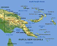
Frederick MD (SPX) Jun 09, 2006 EarthData International announced Thursday it has been awarded a $16 million contract by the Australian government to produce the first-ever high-resolution image and terrain maps of Papua New Guinea. The Australian government is funding the project under a memorandum of understanding with the government of Papua New Guinea. EarthData will deploy its GeoSAR radar mapping system to complete airborne data acquisitions over the 318,000-square-kilometer area. Mounted on a jet aircraft and using two radar bands simultaneously, the GeoSAR system will fly over the area and collect extremely accurate images and three-dimensional models of the forest canopy surface, as well as the terrain beneath the canopy. The resulting data will be used with standard geographic information system software to support decision-making in a variety of land management and engineering applications. "GeoSAR is uniquely qualified for this project," said EarthData CEO Anne Hale Miglarese. "In equatorial regions such as Papua New Guinea, dense vegetation and year-round cloud cover make conventional mapping techniques impossible or cost-prohibitive. The GeoSAR mapping system solves this problem; it is capable of mapping thousands of square kilometers at a time, day or night, and in almost any weather condition to deliver mapping data of a scale, accuracy, and completeness never before possible for this type of topography." Once the two-month aerial data collection phase is completed next month, product delivery will be staged over the remainder of 2006 with final deliveries by June 2007, at which time the majority of the country will be newly mapped. After two years of successfully completing GeoSAR mapping projects in the United States and South America, the Papua New Guinea project is EarthData's first GeoSAR mapping project in the Asia Pacific region. "The quality and clarity of the GeoSAR end products excited us," said Liz Milne, the Australian Government's team leader for this project. "The system's unique capabilities - offering both tree top surface data, as well as ground level data beneath the vegetation - combined with the company's track record on large international mapping projects, sealed our decision to work with EarthData." PNG was last mapped 30 years ago by the Royal Australian Army Survey Corps using methods considered to be state-of-the-art at that time. To complement the radar image maps and terrain models with detailed infrastructure information, Fugro Spatial Solutions Pty Ltd. of Perth, Australia, a team member on this contract, will be responsible for the acquisition of aerial photography over critical infrastructure in 35 individual sites throughout Papua New Guinea. Horizon Geoscience Consultants, of Sydney, Australia, EarthData's strategic partner in the Asia Pacific region for the past 2 years, will provide local project management support, as well as training to Australian Government staff on radar data interpretation. EarthData's objective in developing the GeoSAR system over the past 7 years was to create a cost-effective mapping tool that would enable its customers to have access to accurate and detailed geospatial data of areas where conventional mapping techniques were either impossible or cost-prohibitive. "From the start, we knew that GeoSAR would be an excellent approach for large-area mapping in equatorial regions, and not only because of its technical capabilities," Miglarese said. "In this region," she continued, "where economic development and poverty alleviation are the shared goals of every country, the value of rapidly produced, highly accurate and consistent geographic information is immense. "It serves as a basis for many economic development choices - for example, how to balance the construction of power plants, highways and other essential infrastructure against the protection of natural resources; how to sustain forests while harvesting lumber; what to do about coastal erosion, urban sprawl, and agricultural output." Throughout its history, EarthData has led the mapping industry in developing, adapting and commercializing emerging technologies specifically for mapping purposes. This strategy has been the cornerstone of the company's growth from a small aerial surveying company in 1985 to one of the world's largest privately-held geospatial information companies. EarthData provides a full range of mapping and GIS services to support customers' needs in a wide variety of natural resource management, urban planning, economic development, national defense, and engineering activities. With its fleet of aircraft, the organization collects aerial photography, uses airborne laser and imaging radar systems to produce 3D terrain models, and develops or deploys other remote sensing technologies to detect thermal and multispectral information about the earth's surface. EarthData offices in the United States, Canada and China use this data to create and supply photogrammetric, lidar, radar, and digital orthophoto mapping and GIS applications and services, world-wide. GeoSAR is the world's only airborne radar mapping system that collects dual-band interferometric synthetic aperture radar data in a single pass, day or night, and in almost any weather condition. By acquiring X-band (top surface) and P-band (foliage penetration) IFSAR data simultaneously from each side of the aircraft in a single pass, GeoSAR offers unmatched data quality and detail. Community Email This Article Comment On This Article Related Links EarthData International Earth Observation News - Suppiliers, Technology and Application
 Stanford CA (SPX) Jun 07, 2006
The Carnegie Institution's Department of Global Ecology has signed a one-year contract with ImageONE, a Japanese satellite imaging company based in Tokyo. Under the terms of the agreement, Greg Asner's group will host an ImageONE engineer, who will learn ecological remote sensing and analysis techniques from Asner and his staff. |
|
| The content herein, unless otherwise known to be public domain, are Copyright 1995-2006 - SpaceDaily.AFP and UPI Wire Stories are copyright Agence France-Presse and United Press International. ESA PortalReports are copyright European Space Agency. All NASA sourced material is public domain. Additionalcopyrights may apply in whole or part to other bona fide parties. Advertising does not imply endorsement,agreement or approval of any opinions, statements or information provided by SpaceDaily on any Web page published or hosted by SpaceDaily. Privacy Statement |