 |
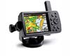
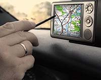
Las Vegas NV (SPX) Aug 12, 2008 Columbus Geographic Systems has announced that it is responding to the growing demand for navigation-related applications by developing a range of customized versions of its leading off-road navigation product, the Ranger. The new versions of the Ranger address applications that are currently not resolved by available navigation products. "As users become more sophisticated, we are seeing a rise in the global demand for new extended navigation-related applications," states Tsvika Friedman, CEO of Columbus Geographic Systems. "We are intensively working an entirely new range of extensions and application versions to meet this growing demand. Among the topics that our development team is currently addressing are customized language interfaces, and customization of applications to specific client needs." Columbus' new modifications include the incorporation of additional information such as dynamic topographic cross-sections, rapid and efficient integration of maps from several different sources, and calculation and alignment of coordinates on different grids. Columbus is also making progress in negotiations with cartographers worldwide with the aim of offering its own clients that largest range of maps available today. Ranger is a cutting-edge navigation software providing location-based, Global Positioning System (GPS) mapping, navigation, and information solutions for the off-road environment. Ranger works on a range of devices including Car PC, PDA, and Personal Navigation Devices (PND). Ranger is an easy to use and affordable navigation tool that reduces the chances of getting lost and gives the exact geographic location to direct rescue services in the event of an emergency. Columbus developed this advanced navigation application from cutting-edge mapping and navigation technology. Ranger uses unique technology to handle raster-based maps which are more complex than vector-based maps used in urban areas. Community Email This Article Comment On This Article Share This Article With Planet Earth
Related Links Columbus Geographic Systems GPS Applications, Technology and Suppliers
 San Diego CA (SPX) Jul 16, 2008
Researchers at San Diego State University have developed a new concept for improving MEMS accelerometer tunability. This method can increase wide-band tunability with ranges much larger than current practice, a significant improvement from the previously accepted 5-10%. |
|
| The content herein, unless otherwise known to be public domain, are Copyright 1995-2007 - SpaceDaily.AFP and UPI Wire Stories are copyright Agence France-Presse and United Press International. ESA Portal Reports are copyright European Space Agency. All NASA sourced material is public domain. Additional copyrights may apply in whole or part to other bona fide parties. Advertising does not imply endorsement,agreement or approval of any opinions, statements or information provided by SpaceDaily on any Web page published or hosted by SpaceDaily. Privacy Statement |
 del.icio.us
 Digg
Digg Reddit
 YahooMyWeb
 Google