|
Las Vegas NV (SPX) Dec 17, 2007 Columbus Geographic Systems (GIS) Ltd. has announced the start of development of the world's first comprehensive navigation solution, displaying both urban and off-road maps without the need to move between different software or change memory cards. Navigation systems are software developed for car computers and PDAs enabling travelers to find their location, plan their route, exchange routes with other users, and more. The software uses satellite Global Positioning System (GPS) data to show location and can be used anywhere in the world, wherever maps are available. Navigation systems in general use today divide into two broad categories; urban, and off-road. Urban navigation applications use vector-based maps called vector graphics. This map-type contains objects such as city names, and street names, which are stored in data tables inside the map itself. In contrast, off-road navigation applications use raster-based (raster graphics) maps, which are essentially scanned maps. Columbus' current navigation software, Ranger, focuses on the off-road environment. The Company's new system will be the first in the world to offer a comprehensive navigation solution with aerial maps covering both urban and off-road environments. Columbus expects the new software to be ready for marketing in the first quarter of 2008. "We are developing a first-of-its-kind navigation solution that covers all environments," said Columbus CEO Mr. Tsvika Freidman. "There is strong market demand in the US and Europe for navigation systems, particularly in vehicles. Our new solution will mean that travelers can easily benefit from GPS navigation using a single software application. We will continue to maintain our technological lead in the market through first-class product development such as this." Community Email This Article Comment On This Article Related Links Columbus Geographic Systems GPS Applications, Technology and Suppliers
 Chicago IL (SPX) Dec 17, 2007
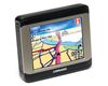
NAVTEQ reports that Lowrance has selected NAVTEQ as the map provider for its new mobile navigation device. The XOG Crossover Navigation GPS will utilize comprehensive NAVTEQ maps for the United States and Canada. |
|
| The content herein, unless otherwise known to be public domain, are Copyright 1995-2007 - SpaceDaily.AFP and UPI Wire Stories are copyright Agence France-Presse and United Press International. ESA Portal Reports are copyright European Space Agency. All NASA sourced material is public domain. Additional copyrights may apply in whole or part to other bona fide parties. Advertising does not imply endorsement,agreement or approval of any opinions, statements or information provided by SpaceDaily on any Web page published or hosted by SpaceDaily. Privacy Statement |