|
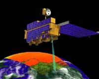
New York - Apr 8, 2002 The U. S. military has begun to use pictures from advanced new NASA civilian satellites to help plan attacks on Al Qaeda fighters in Afghanistan and to prepare for future military strikes possibly against Iraq, Aviation Week & Space Technology reports in its April 8 issue. U. S. Navy sources also told AW&ST that NASA civilian satellite data are also likely helping to support U. S. intelligence operations in the Middle East in connection with the Israeli/Palestinian crisis. The increased NASA role in military space operations in the war on terror could raise concerns in Congress, however, about whether the space agency is staying within its civilian charter, AW&ST said. Pictures of Afghanistan from the NASA SeaWiFS and Terra satellites are enabling greater precision for safer military helicopter operations and better information for determination of whether laser or satellite guided weapons should be called in against specific targets, Capt. Robert L. Clark of the Navy Space & Naval Warfare Systems Command told AW&ST. The greater use of NASA imaging spacecraft and increased dependence of the U. S. military on commercial communications satellites, are part of a special report on overall U. S. military space operations in the April 8 issue of AW&ST. "The U. S. military space community is undergoing revolutionary changes, while simultaneously demonstrating the relevance of space resources in the war on terror," Aviation Week said. Top U. S. military officers told AW&ST that the 1993 "Blackhawk Down" tragedy in Somalia, that cost the lives of more than a dozen U. S. soldiers, proved to be "a wake-up call" for far better military satellite communications and the better integration of such capabilities with U. S. forces. The magazine said that sweeping changes in how the U. S. uses its military satellites are also underway in response to findings made by a commission headed by Donald Rumsfeld just before he became Secretary of Defense. Military space systems involve dozens of different spacecraft that provide navigation, intelligence, weather, communications and other services to troops on the ground. The Air Force Space Command alone previously spent $2 billion per year on satellite operations--but is now spending $8 billion per year. One serious issue, however, is that the leadership in both the Air Force and Navy is top heavy with jet fighter pilots who have never had much interest in space. This is a problem because space systems are increasingly the lifeblood of overall U. S. military operations on the ground. Community Email This Article Comment On This Article Related Links Aviation Week & Space Technology SpaceDaily Search SpaceDaily Subscribe To SpaceDaily Express Earth Observation News - Suppiliers, Technology and Application
 New York NY (SPX) Jan 11, 2006
The importance of remotely sensed data and technologies to support natural disasters has prompted attention and action in Washington. New initiatives and legislation authorizing appropriations to the remote sensing industry will be discussed at Strategic Research Institute's U.S. Commercial Remote Sensing Industry conference, scheduled for February 9-10, 2006 in Washington D.C. |
|
| The content herein, unless otherwise known to be public domain, are Copyright 1995-2006 - SpaceDaily.AFP and UPI Wire Stories are copyright Agence France-Presse and United Press International. ESA PortalReports are copyright European Space Agency. All NASA sourced material is public domain. Additionalcopyrights may apply in whole or part to other bona fide parties. Advertising does not imply endorsement,agreement or approval of any opinions, statements or information provided by SpaceDaily on any Web page published or hosted by SpaceDaily. Privacy Statement |