|
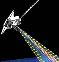
St Louis MO (SPX) Mar 01, 2006 Boeing has received a $3.5 million follow-on task order from the National Geospatial-Intelligence Agency (NGA) to enhance the digital topographic data collected by the space shuttle Endeavour. This award to Boeing under NGA's Shuttle Radar Topography Mission (SRTM) program brings Boeing's total SRTM contract awards to more than $35 million. The task order was awarded under NGA's Global Geospatial Intelligence (GGI) contract that was designed to enhance NGA's ability to provide critical, time-sensitive, intelligence and geospatial information for the Department of Defense. Boeing is a prime contractor for GGI, which has a potential value of $750 million over 10 years. "This award demonstrates the continuing successful partnership between Boeing and NGA," said Brian Knutsen, general manager of Boeing's Space and Intelligence Systems Mission Systems. "The availability of this information to Department of Defense agencies will enable greater use of data that was collected by the shuttle radar, and it moves the team one step closer to a full global data set." This follow-on tasking, known as Void Fill, will update terrain models in geographic locations where Endeavour's radar sensor had difficulty collecting data in February 2000. The enhancements include the removal of certain radar processing anomalies and filling areas with data from alternate elevation data sources. Boeing is one of two GGI prime contractor teams that were awarded initial SRTM data finishing task orders. To date, the team has produced more than 9,000 cells of Digital Terrain Elevation Data (DTED�) and enhanced approximately 7,000 cells over portions of four continents with each cell being one degree of latitude by one degree of longitude in size. Boeing is responsible for the overall project management of its team and development of the interactive editing system interface and editing software that is being used to produce the data at Boeing. The SRTM mission aboard Endeavour used radar sensors to collect the most detailed and accurate height measurements ever gathered for such a large area. The goal of the SRTM production program is to produce digital topographic data for 80 percent of the Earth's land surface. Automation of most tasks has reduced editing time and minimized production costs, as compared to previous systems for producing similar data. Community Email This Article Comment On This Article Related Links Boeing National Geospatial-Intelligence Agency Earth Observation News - Suppiliers, Technology and Application
 Paris, France (SPX) Mar 01, 2006
Since its launch in 2002, Envisat, the world's largest and most sophisticated satellite ever built, has been providing scientists and operational users with invaluable data for global monitoring and forecasting � and the future looks even brighter. |
|
| The content herein, unless otherwise known to be public domain, are Copyright 1995-2006 - SpaceDaily.AFP and UPI Wire Stories are copyright Agence France-Presse and United Press International. ESA PortalReports are copyright European Space Agency. All NASA sourced material is public domain. Additionalcopyrights may apply in whole or part to other bona fide parties. Advertising does not imply endorsement,agreement or approval of any opinions, statements or information provided by SpaceDaily on any Web page published or hosted by SpaceDaily. Privacy Statement |